Area Overview for GU10 4DB
Photos of GU10 4DB
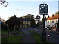
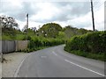
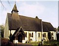
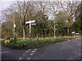
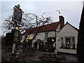
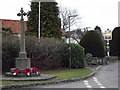

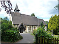
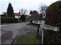


15 photos from this area
Area Information
Key information about the GU10 4DB including its size, population, and administrative classification.
- Area Type
- Postcode
- Area Size
- 8.6 hectares
- Population
- 1424
- Population Density
- 698 people/km²
House Prices in GU10 4DB
28
Properties
£747,233
Average Sold Price
£25,000
Lowest Price
£1,700,000
Highest Price
Showing 28 properties
| Address | Type | Beds | Baths | Last Sale Price | Last Sale Date | |
|---|---|---|---|---|---|---|
| 29 Rosemary Lane, Rowledge, Farnham, GU10 4DB | Detached | 5 | 2 | £1,600,000 | Sep 2022 | |
| Brook House, Rosemary Lane, Rowledge, Farnham, GU10 4DB | Detached | 3 | 2 | £600,000 | Sep 2021 | |
| 4 Rosemary Lane, Rowledge, Farnham, GU10 4DB | Semi-detached | 3 | 2 | £725,000 | Jan 2021 | |
| Goodison Lodge, Rosemary Lane, Rowledge, Farnham, GU10 4DB | Detached | 4 | 4 | £760,000 | Aug 2020 | |
| Fair Valley Farm, 6A Rosemary Lane, Rowledge, Farnham, GU10 4DB | Detached | 5 | 3 | £1,700,000 | Mar 2020 | |
| 9A Rosemary Lane, Rowledge, Farnham, GU10 4DB | Bungalow | - | - | £875,000 | Nov 2018 | |
| 10 Rosemary Lane, Rowledge, Farnham, GU10 4DB | Bungalow | 4 | 1 | £710,000 | Sep 2017 | |
| 21 Rosemary Lane, Rowledge, Farnham, GU10 4DB | Detached | 4 | 3 | £900,000 | Sep 2016 | |
| Willow Tree Cottage, 25 Rosemary Lane, Rowledge, Farnham, GU10 4DB | house | 5 | - | £560,000 | Mar 2012 | |
| 16 Rosemary Lane, Rowledge, Farnham, GU10 4DB | house | - | - | £850,000 | Jun 2010 |
Page 1 of 3
Energy Efficiency in GU10 4DB
Amenities
Schools
| Rank | School | Type | Entry gender | Ages |
|---|
Explore more schools in this area
Go to Schools tabDemographics
Household Size
Two person
most common
Accommodation Type
Houses
most common
Tenure
89
majority
Ethnic Group
White
most common
Religion
N/A
most common
Household Composition
N/A
most common
Age
47
median
Adults (30-64 years)
most common
Household Deprivation
N/A
with no deprivation
NS-SEC
55
in Lower managerial occupations
Explore more demographic insights in this area
Go to Demographics tabPlanning
Planning Constraints
- Flood RiskPremium
- Ramsar Wetland SitesPremium
- Area of Outstanding Natural BeautyPremium
- Protected Nature ReservePremium
- Protected WoodlandPremium