Area Overview for GU10 3RP
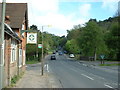
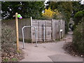
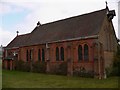
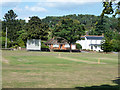
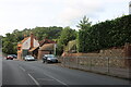
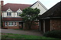
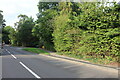
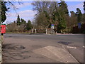
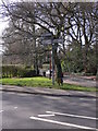
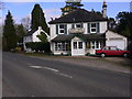
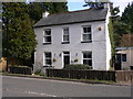
Photos of GU10 3RP

Area Information
GU10 3RP is a small, tightly packed residential postcode in England, home to 1,487 people spread over a compact area with a population density of 651 people per square kilometre. This suggests a closely knit community, where neighbours are likely to know one another. The area is characterised by a mature demographic, with a median age of 47 and a strong presence of adults aged 30–64. Most residents are homeowners, with 82% owning their properties, indicating a stable and settled population. Daily life here is shaped by its proximity to essential services and transport links. The area’s small size means it is likely to have a distinct local identity, though it is not isolated—its residents benefit from nearby amenities and connectivity. Living in GU10 3RP offers a balance of residential tranquillity and practical access to retail, transport, and leisure options, making it suitable for those seeking a community-oriented lifestyle without sacrificing convenience.
- Area Type
- Postcode
- Area Size
- Not available
- Population
- 1487
- Population Density
- 651 people/km²
The property market in GU10 3RP is dominated by owner-occupied homes, with 82% of residents owning their properties. This suggests a market that is less influenced by rental demand and more focused on long-term residency. The accommodation type is predominantly houses, which may indicate a preference for family homes or larger properties compared to flats. Given the small size of the area, the housing stock is likely limited, meaning buyers may need to consider nearby postcode areas for more options. The high home ownership rate implies that properties here are likely to be well-maintained and stable in value. For buyers, this means a market where properties are not frequently changing hands, and transactions may involve established homes rather than new developments. The focus on houses also suggests that the area may appeal to those seeking space and privacy, though the compact nature of the postcode could limit availability.
House Prices in GU10 3RP
No properties found in this postcode.
Energy Efficiency in GU10 3RP
Living in GU10 3RP offers access to a range of amenities within easy reach. The area is served by five retail outlets, including Tesco Ridgway, Sainsburys Farnham, and M&S Farnham BP, providing everyday shopping and dining options. For transport, five railway stations—Farnham, Aldershot, and Bentley—offer connections to nearby towns and cities, while Farnborough Airport is a short distance away, adding to the area’s accessibility. Although specific parks or leisure facilities are not listed in the data, the proximity to multiple transport hubs suggests a well-connected community. The presence of major retailers and transport links contributes to a convenient lifestyle, allowing residents to balance local amenities with broader opportunities. This mix of retail, transport, and travel options makes GU10 3RP a practical choice for those seeking both daily convenience and regional connectivity.
Amenities
Schools
| Rank | School | Type | Entry gender | Ages |
|---|
Explore more schools in this area
Go to Schools tabDemographics
The community in GU10 3RP is predominantly composed of adults aged 30–64, with a median age of 47. This suggests a population that is largely established in careers and family life, contributing to a mature, stable local environment. Home ownership is high, with 82% of residents owning their homes, reflecting a preference for long-term residency over rental properties. The area is primarily composed of houses, which aligns with the demographic profile of families and individuals seeking more space than flats. The predominant ethnic group is White, which is consistent with broader regional trends. While specific data on deprivation is not provided, the high home ownership rate and low crime risk imply a relatively affluent and secure community. This demographic structure likely influences local services, with amenities tailored to the needs of middle-aged adults and families.
Household Size
Accommodation Type
Tenure
Ethnic Group
Religion
Household Composition
Age
Household Deprivation
NS-SEC
Explore more demographic insights in this area
Go to Demographics tabPlanning
Planning Constraints
- Flood RiskPremium
- Ramsar Wetland SitesPremium
- Area of Outstanding Natural BeautyPremium
- Protected Nature ReservePremium
- Protected WoodlandPremium