Area Overview for GU10 3JL
Photos of GU10 3JL
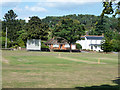
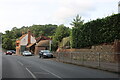
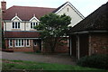
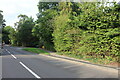
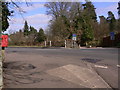
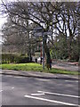
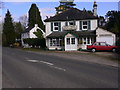
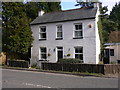
18 photos from this area
Area Information
Key information about the GU10 3JL including its size, population, and administrative classification.
- Area Type
- Postcode
- Area Size
- 4.5 hectares
- Population
- 1463
- Population Density
- 1909 people/km²
House Prices in GU10 3JL
22
Properties
£859,417
Average Sold Price
£592,000
Lowest Price
£1,100,000
Highest Price
Showing 22 properties
| Address | Type | Beds | Baths | Last Sale Price | Last Sale Date | |
|---|---|---|---|---|---|---|
| 25 Longdown Road, Lower Bourne, Farnham, GU10 3JL | Detached | 3 | 2 | £1,100,000 | Mar 2025 | |
| Sylvan Cottage, Longdown Road, Lower Bourne, Farnham, GU10 3JL | Detached | 5 | - | £875,000 | Aug 2021 | |
| Woodroffe House, Longdown Road, Lower Bourne, Farnham, GU10 3JL | Detached | 5 | 3 | £912,000 | Jul 2019 | |
| 30 Longdown Road, Lower Bourne, Farnham, GU10 3JL | Flat | 1 | 1 | £722,500 | Mar 2017 | |
| Vine Cottage, 32 Longdown Road, Lower Bourne, Farnham, GU10 3JL | Detached | 5 | 2 | £955,000 | May 2015 | |
| Woodside, 21 Longdown Road, Lower Bourne, Farnham, GU10 3JL | Detached | - | - | £592,000 | Aug 2005 | |
| Wood Haven, 33 Longdown Road, Lower Bourne, Farnham, GU10 3JL | Detached | 5 | 3 | - | - | |
| Springfield Lodge, 28 Longdown Road, Lower Bourne, Farnham, GU10 3JL | Detached | 5 | 2 | - | - | |
| Dial House West, 24 Longdown Road, Lower Bourne, Farnham, GU10 3JL | Detached | 5 | 2 | - | - | |
| 29 Longdown Road, Lower Bourne, Farnham, GU10 3JL | Detached | 5 | 3 | - | - |
Page 1 of 3
Energy Efficiency in GU10 3JL
Amenities
Schools
| Rank | School | Type | Entry gender | Ages |
|---|
Explore more schools in this area
Go to Schools tabDemographics
Household Size
Family (3-5 people)
most common
Accommodation Type
Houses
most common
Tenure
90
majority
Ethnic Group
White
most common
Religion
N/A
most common
Household Composition
N/A
most common
Age
47
median
Adults (30-64 years)
most common
Household Deprivation
N/A
with no deprivation
NS-SEC
61
in Lower managerial occupations
Explore more demographic insights in this area
Go to Demographics tabPlanning
Planning Constraints
- Flood RiskPremium
- Ramsar Wetland SitesPremium
- Area of Outstanding Natural BeautyPremium
- Protected Nature ReservePremium
- Protected WoodlandPremium