Area Overview for GU10 3HR
Photos of GU10 3HR
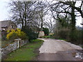
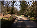
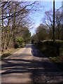
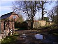

15 photos from this area
Area Information
Key information about the GU10 3HR including its size, population, and administrative classification.
- Area Type
- Postcode
- Area Size
- 5.4 hectares
- Population
- 1542
- Population Density
- 499 people/km²
House Prices in GU10 3HR
29
Properties
£577,000
Average Sold Price
£175,000
Lowest Price
£1,035,000
Highest Price
Showing 29 properties
| Address | Type | Beds | Baths | Last Sale Price | Last Sale Date | |
|---|---|---|---|---|---|---|
| Woodside, 9 Vale Close, Lower Bourne, Farnham, GU10 3HR | Detached | 5 | 2 | £1,035,000 | Jul 2025 | |
| 20 Vale Close, Lower Bourne, Farnham, GU10 3HR | Detached | 4 | 4 | £995,000 | Feb 2021 | |
| 8 Vale Close, Lower Bourne, Farnham, GU10 3HR | Detached | 5 | 3 | £760,000 | Aug 2020 | |
| 13 Vale Close, Lower Bourne, Farnham, GU10 3HR | Bungalow | 5 | 2 | £635,000 | Apr 2020 | |
| Laurel House, 10 Vale Close, Lower Bourne, Farnham, GU10 3HR | Bungalow | 2 | 1 | £585,000 | Oct 2018 | |
| Birchwood, 7 Vale Close, Lower Bourne, Farnham, GU10 3HR | Bungalow | 4 | 2 | £766,000 | Oct 2018 | |
| 3 Vale Close, Lower Bourne, Farnham, GU10 3HR | Bungalow | 4 | 1 | £660,000 | Oct 2017 | |
| 21 Vale Close, Lower Bourne, Farnham, GU10 3HR | Bungalow | 4 | 2 | £728,000 | Jun 2016 | |
| 6 Vale Close, Lower Bourne, Farnham, GU10 3HR | Bungalow | 2 | 1 | £720,000 | May 2016 | |
| 29 Vale Close, Lower Bourne, Farnham, GU10 3HR | Bungalow | - | - | £530,000 | Jun 2014 |
Page 1 of 3
Energy Efficiency in GU10 3HR
Amenities
Schools
| Rank | School | Type | Entry gender | Ages |
|---|
Explore more schools in this area
Go to Schools tabDemographics
Household Size
Family (3-5 people)
most common
Accommodation Type
Houses
most common
Tenure
93
majority
Ethnic Group
White
most common
Religion
N/A
most common
Household Composition
N/A
most common
Age
47
median
Adults (30-64 years)
most common
Household Deprivation
N/A
with no deprivation
NS-SEC
57
in Lower managerial occupations
Explore more demographic insights in this area
Go to Demographics tabPlanning
Planning Constraints
- Flood RiskPremium
- Ramsar Wetland SitesPremium
- Area of Outstanding Natural BeautyPremium
- Protected Nature ReservePremium
- Protected WoodlandPremium