Area Overview for GU10 2QD
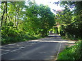
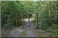
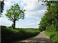
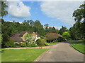
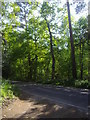
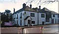
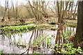
Photos of GU10 2QD


Area Information
Living in GU10 2QD offers a quiet, compact residential experience in a small cluster of homes. With a population of 1,157 spread across 4,683 square metres, the area maintains a low density of 247 people per square kilometre, ensuring a sense of space and privacy. This postcode is characterised by its predominantly older residents, with a median age of 47 and a majority of adults aged 30–64. The area’s modest size means it is ideal for those seeking a close-knit community, though its small footprint also means amenities and services are concentrated within a short radius. Nearby, St John’s CofE Aided Infant School and Pathways Education provide educational options, while rail links to Bentley, Farnham, and Haslemere stations connect residents to larger towns. Daily life here is defined by simplicity: local shops, low crime rates, and minimal environmental constraints. The area’s safety profile is strong, with a crime risk score of 85, and flood risk is negligible. For buyers prioritising tranquillity over urban vibrancy, GU10 2QD offers a straightforward, low-maintenance lifestyle.
- Area Type
- Postcode
- Area Size
- 4683 m²
- Population
- 1157
- Population Density
- 247 people/km²
The property market in GU10 2QD is largely owner-occupied, with 74% of homes owned by residents rather than rented. This suggests a stable, long-term demographic with little turnover. The accommodation type is predominantly houses, which contrasts with areas dominated by flats or apartments. The small area size of 4,683 square metres means the housing stock is limited, and buyers may need to consider nearby postcodes for more options. The high home ownership rate indicates demand for private residences, though the lack of rental properties suggests limited investment activity. For buyers, this means properties here are likely to be family homes rather than speculative purchases. The absence of planning constraints or protected areas also makes development less restricted, potentially offering flexibility for future modifications. However, the small size of the area means competition for properties may be higher, and buyers should assess the broader regional market for comparable options.
House Prices in GU10 2QD
No properties found in this postcode.
Energy Efficiency in GU10 2QD
The lifestyle in GU10 2QD is defined by simplicity and proximity to essential services. Within practical reach are five retail outlets, including Spar, Budgens Beech, and The Southern Co-operative, offering everyday shopping needs. These shops provide convenience for residents, reducing the need for long journeys to larger towns. The rail network, with stations at Bentley, Farnham, and Haslemere, connects the area to broader regional services, enabling access to more extensive amenities in nearby towns. While the area lacks large parks or recreational facilities, the absence of planning constraints and low population density suggests open spaces may be available for leisure. The character of daily life here is low-key, with a focus on local essentials and minimal commuting. For those valuing self-sufficiency and a quiet environment, the combination of nearby retail and rail links offers a balanced lifestyle, though larger-scale leisure or cultural activities may require travel beyond the immediate area.
Amenities
Schools
Residents of GU10 2QD have access to two notable schools within practical reach. St John’s CofE Aided Infant School is a primary school with a Good Ofsted rating, providing early education for younger children. Pathways Education is a special school, also rated Good, catering to students with specific educational needs. This combination of school types ensures families have options for both mainstream and specialist education. The presence of a primary school suggests the area supports families with young children, though the absence of secondary schools may require commuting to nearby towns. The Good ratings indicate reliable standards, but parents should consider the need for additional schooling beyond primary level. For those prioritising accessible education, the proximity of these schools is a practical advantage, though the limited range of school types may necessitate planning for secondary education elsewhere.
| Rank | School | Type | Entry gender | Ages |
|---|
Explore more schools in this area
Go to Schools tabDemographics
The community in GU10 2QD is predominantly composed of adults aged 30–64, with a median age of 47. Home ownership is high, at 74%, reflecting a stable, long-term resident base. The area is almost entirely occupied by houses, rather than flats or apartments, which aligns with its older demographic and lower population density. The predominant ethnic group is White, with no specific data provided on other groups. The low population density of 247 people per square kilometre suggests a spread-out, less crowded environment. This profile indicates a mature, settled community with limited generational turnover. For quality of life, the high home ownership rate and absence of significant deprivation markers suggest residents have secure housing and stable incomes. The age distribution also implies a workforce with established careers, though the lack of younger families may influence local services and amenities.
Household Size
Accommodation Type
Tenure
Ethnic Group
Religion
Household Composition
Age
Household Deprivation
NS-SEC
Explore more demographic insights in this area
Go to Demographics tabPlanning
Planning Constraints
- Flood RiskPremium
- Ramsar Wetland SitesPremium
- Area of Outstanding Natural BeautyPremium
- Protected Nature ReservePremium
- Protected WoodlandPremium