Area Overview for GU10 2HS
Photos of GU10 2HS
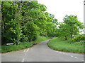
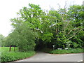
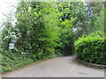
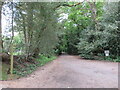
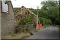
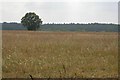
10 photos from this area
Area Information
Key information about the GU10 2HS including its size, population, and administrative classification.
- Area Type
- Postcode
- Area Size
- 7.2 hectares
- Population
- 1157
- Population Density
- 247 people/km²
House Prices in GU10 2HS
10
Properties
£1,167,857
Average Sold Price
£740,000
Lowest Price
£1,700,000
Highest Price
Showing 10 properties
| Address | Type | Beds | Baths | Last Sale Price | Last Sale Date | |
|---|---|---|---|---|---|---|
| Larchwood House, Star Hill, Churt, Farnham, GU10 2HS | house | - | - | £975,000 | Jan 2022 | |
| Mayrose Barn, Star Hill, Churt, Farnham, GU10 2HS | Detached | 5 | 4 | £925,000 | Jan 2022 | |
| Ashby House, Star Hill, Churt, Farnham, GU10 2HS | Detached | 5 | 3 | £1,700,000 | Jun 2017 | |
| Derwen, Star Hill, Churt, Farnham, GU10 2HS | Detached | 6 | 3 | £1,275,000 | Oct 2015 | |
| Chinton Cottage, Star Hill, Churt, Farnham, GU10 2HS | Bungalow | 3 | 2 | £740,000 | Aug 2014 | |
| Chinton Lodge, Star Hill, Churt, Farnham, GU10 2HS | house | 5 | - | £1,060,000 | Jan 2012 | |
| Fallowfield, Star Hill, Churt, Farnham, GU10 2HS | Detached | - | - | £1,500,000 | Apr 2008 | |
| Furze Hill Farm, Star Hill, Churt, Farnham, GU10 2HS | Detached | 4 | 3 | - | - | |
| 1, Edwin Abbott Memorial Cottages, Star Hill, Churt, Farnham, GU10 2HS | Semi-detached | - | - | - | - | |
| 2, Edwin Abbott Memorial Cottages, Star Hill, Churt, Farnham, GU10 2HS | house | - | - | - | - |
Energy Efficiency in GU10 2HS
Amenities
Schools
| Rank | School | Type | Entry gender | Ages |
|---|
Explore more schools in this area
Go to Schools tabDemographics
Household Size
Two person
most common
Accommodation Type
Houses
most common
Tenure
74
majority
Ethnic Group
White
most common
Religion
N/A
most common
Household Composition
N/A
most common
Age
47
median
Adults (30-64 years)
most common
Household Deprivation
N/A
with no deprivation
NS-SEC
52
in Lower managerial occupations
Explore more demographic insights in this area
Go to Demographics tabPlanning
Planning Constraints
- Flood RiskPremium
- Ramsar Wetland SitesPremium
- Area of Outstanding Natural BeautyPremium
- Protected Nature ReservePremium
- Protected WoodlandPremium