Area Overview for GU10 2BP
Photos of GU10 2BP

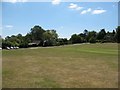

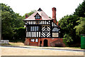

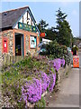
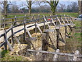


94 photos from this area
Area Information
Key information about the GU10 2BP including its size, population, and administrative classification.
- Area Type
- Postcode
- Area Size
- 26.5 hectares
- Population
- 1677
- Population Density
- 83 people/km²
House Prices in GU10 2BP
11
Properties
£1,036,667
Average Sold Price
£250,000
Lowest Price
£3,100,000
Highest Price
Showing 11 properties
| Address | Type | Beds | Baths | Last Sale Price | Last Sale Date | |
|---|---|---|---|---|---|---|
| Meads Cottage, Whitmead Lane, Tilford, Farnham, GU10 2BP | Detached | 4 | 2 | £950,000 | Oct 2023 | |
| Lane House, Whitmead Lane, Tilford, Farnham, GU10 2BP | house | - | - | £3,100,000 | Dec 2022 | |
| Field Barn, Whitmead Lane, Tilford, Farnham, GU10 2BP | house | - | - | £670,000 | Apr 2021 | |
| Bracken Wood, Whitmead Lane, Tilford, Farnham, GU10 2BP | Detached | 3 | 1 | £610,000 | Dec 2018 | |
| Tile House, Whitmead Lane, Tilford, Farnham, GU10 2BP | Detached | - | - | £640,000 | Sep 2000 | |
| Corner Close, Whitmead Lane, Tilford, Farnham, GU10 2BP | Detached | - | - | £250,000 | Oct 1997 | |
| Tubster Cottage, Whitmead Lane, Tilford, Farnham, GU10 2BP | Land | 5 | 3 | - | - | |
| Oakfield, Whitmead Lane, Tilford, Farnham, GU10 2BP | Detached | 4 | - | - | - | |
| Bog, Whitmead Lane, Tilford, Farnham, GU10 2BP | Detached | - | - | - | - | |
| Undercliffe Farm, Whitmead Lane, Tilford, Farnham, GU10 2BP | Semi-detached | - | - | - | - |
Page 1 of 2
Energy Efficiency in GU10 2BP
Amenities
Schools
| Rank | School | Type | Entry gender | Ages |
|---|
Explore more schools in this area
Go to Schools tabDemographics
Household Size
Two person
most common
Accommodation Type
Houses
most common
Tenure
80
majority
Ethnic Group
White
most common
Religion
N/A
most common
Household Composition
N/A
most common
Age
47
median
Adults (30-64 years)
most common
Household Deprivation
N/A
with no deprivation
NS-SEC
50
in Lower managerial occupations
Explore more demographic insights in this area
Go to Demographics tabPlanning
Planning Constraints
- Flood RiskPremium
- Ramsar Wetland SitesPremium
- Area of Outstanding Natural BeautyPremium
- Protected Nature ReservePremium
- Protected WoodlandPremium