Area Overview for GU10 1QD
Photos of GU10 1QD
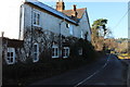
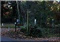
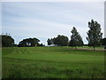
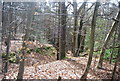
27 photos from this area
Area Information
Key information about the GU10 1QD including its size, population, and administrative classification.
- Area Type
- Postcode
- Area Size
- 12.8 hectares
- Population
- 1721
- Population Density
- 364 people/km²
House Prices in GU10 1QD
27
Properties
£1,036,375
Average Sold Price
£415,000
Lowest Price
£1,600,000
Highest Price
Showing 27 properties
| Address | Type | Beds | Baths | Last Sale Price | Last Sale Date | |
|---|---|---|---|---|---|---|
| Oakwood, 29 Crooksbury Road, Farnham, GU10 1QD | Detached | 5 | 2 | £1,380,000 | Oct 2018 | |
| Tanglewood, 27 Crooksbury Road, Farnham, GU10 1QD | Bungalow | 5 | 3 | £1,036,499 | Feb 2017 | |
| Tall Timbers, 78 Crooksbury Road, Farnham, GU10 1QD | Detached | 5 | 2 | £1,260,000 | Oct 2015 | |
| Foxwood House, 19 Crooksbury Road, Farnham, GU10 1QD | Detached | 5 | 4 | £1,380,000 | Apr 2015 | |
| Setters, 33 Crooksbury Road, Farnham, GU10 1QD | Bungalow | 3 | - | £880,000 | Aug 2014 | |
| 80 Crooksbury Road, Farnham, GU10 1QD | Detached | 5 | - | £1,600,000 | Apr 2013 | |
| 74 Crooksbury Road, Farnham, GU10 1QD | Detached | - | - | £860,000 | Aug 2007 | |
| Hillcrest, 62 Crooksbury Road, Farnham, GU10 1QD | Detached | - | - | £1,050,000 | Jul 2006 | |
| Thornywood, 82 Crooksbury Road, Farnham, GU10 1QD | Detached | 5 | 5 | £825,000 | Jul 2006 | |
| Silvers, 25 Crooksbury Road, Farnham, GU10 1QD | Detached | - | - | £750,000 | Apr 2006 |
Page 1 of 3
Energy Efficiency in GU10 1QD
Amenities
Schools
| Rank | School | Type | Entry gender | Ages |
|---|
Explore more schools in this area
Go to Schools tabDemographics
Household Size
Two person
most common
Accommodation Type
Houses
most common
Tenure
89
majority
Ethnic Group
White
most common
Religion
N/A
most common
Household Composition
N/A
most common
Age
47
median
Adults (30-64 years)
most common
Household Deprivation
N/A
with no deprivation
NS-SEC
54
in Lower managerial occupations
Explore more demographic insights in this area
Go to Demographics tabPlanning
Planning Constraints
- Flood RiskPremium
- Ramsar Wetland SitesPremium
- Area of Outstanding Natural BeautyPremium
- Protected Nature ReservePremium
- Protected WoodlandPremium