Area Overview for GU10 1DS
Photos of GU10 1DS
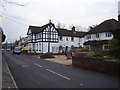


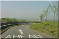
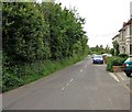
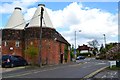
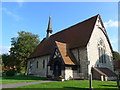
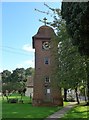
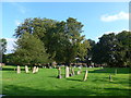
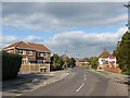
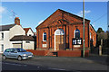
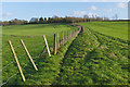
56 photos from this area
Area Information
Key information about the GU10 1DS including its size, population, and administrative classification.
- Area Type
- Postcode
- Area Size
- 1.7 hectares
- Population
- 1728
- Population Density
- 547 people/km²
House Prices in GU10 1DS
23
Properties
£436,033
Average Sold Price
£347,000
Lowest Price
£530,000
Highest Price
Showing 23 properties
| Address | Type | Beds | Baths | Last Sale Price | Last Sale Date | |
|---|---|---|---|---|---|---|
| New Glade, Poyle Road, Tongham, GU10 1DS | Terraced | 3 | 1 | £347,000 | Jul 2025 | |
| 20 Poyle Road, Tongham, GU10 1DS | Terraced | 2 | 1 | £382,000 | Aug 2022 | |
| 21 Poyle Road, Tongham, GU10 1DS | Semi-detached | 3 | 2 | £505,000 | Mar 2021 | |
| 12 Poyle Road, Tongham, GU10 1DS | Detached | 4 | 2 | £420,000 | Feb 2021 | |
| 8 Poyle Road, Tongham, GU10 1DS | Semi-detached | 4 | - | £530,000 | Jan 2021 | |
| Brookleigh, Poyle Road, Tongham, GU10 1DS | Bungalow | 2 | 1 | £360,000 | Oct 2019 | |
| 14A Poyle Road, Tongham, GU10 1DS | Detached | 3 | 1 | £357,000 | Jun 2019 | |
| 14 Poyle Road, Tongham, GU10 1DS | Semi-detached | 6 | 3 | £485,000 | Apr 2019 | |
| 16 Poyle Road, Tongham, GU10 1DS | Terraced | 3 | 2 | £425,000 | Jul 2018 | |
| 15 Poyle Road, Tongham, GU10 1DS | Terraced | 3 | 1 | £455,000 | Dec 2017 |
Page 1 of 3
Energy Efficiency in GU10 1DS
Amenities
Schools
| Rank | School | Type | Entry gender | Ages |
|---|
Explore more schools in this area
Go to Schools tabDemographics
Household Size
Two person
most common
Accommodation Type
Houses
most common
Tenure
73
majority
Ethnic Group
White
most common
Religion
N/A
most common
Household Composition
N/A
most common
Age
47
median
Adults (30-64 years)
most common
Household Deprivation
N/A
with no deprivation
NS-SEC
38
in Lower managerial occupations
Explore more demographic insights in this area
Go to Demographics tabPlanning
Planning Constraints
- Flood RiskPremium
- Ramsar Wetland SitesPremium
- Area of Outstanding Natural BeautyPremium
- Protected Nature ReservePremium
- Protected WoodlandPremium