Area Overview for GU1 2JA
Photos of GU1 2JA
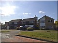
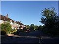
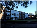
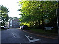
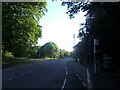
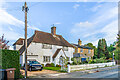
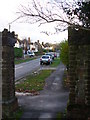
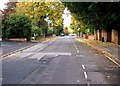
52 photos from this area
Area Information
Key information about the GU1 2JA including its size, population, and administrative classification.
- Area Type
- Postcode
- Area Size
- 2.9 hectares
- Population
- 1731
- Population Density
- 1920 people/km²
House Prices in GU1 2JA
31
Properties
£571,496
Average Sold Price
£151,050
Lowest Price
£1,225,000
Highest Price
Showing 31 properties
| Address | Type | Beds | Baths | Last Sale Price | Last Sale Date | |
|---|---|---|---|---|---|---|
| 10 Tormead Road, Guildford, GU1 2JA | Detached | 3 | 1 | £575,000 | Mar 2025 | |
| 16 Tormead Road, Guildford, GU1 2JA | Bungalow | 3 | 1 | £670,000 | Dec 2023 | |
| 1 Tormead Road, Guildford, GU1 2JA | Detached | 5 | - | £1,225,000 | Feb 2022 | |
| 8 Tormead Road, Guildford, GU1 2JA | Bungalow | - | - | £659,000 | Jun 2021 | |
| 14 Tormead Road, Guildford, GU1 2JA | Bungalow | - | - | £645,000 | Jun 2021 | |
| 12 Tormead Road, Guildford, GU1 2JA | Bungalow | 3 | 1 | £635,000 | Nov 2018 | |
| 11 Tormead Road, Guildford, GU1 2JA | Detached | 4 | 2 | £802,000 | Jan 2017 | |
| 5 Tormead Road, Guildford, GU1 2JA | Detached | 4 | - | £725,000 | Jul 2014 | |
| 21 Tormead Road, Guildford, GU1 2JA | house | 5 | 3 | £925,000 | Jun 2014 | |
| 4 Tormead Road, Guildford, GU1 2JA | house | 4 | - | £649,950 | Jan 2013 |
Page 1 of 4
Energy Efficiency in GU1 2JA
Amenities
Schools
| Rank | School | Type | Entry gender | Ages |
|---|
Explore more schools in this area
Go to Schools tabDemographics
Household Size
Family (3-5 people)
most common
Accommodation Type
Houses
most common
Tenure
86
majority
Ethnic Group
White
most common
Religion
N/A
most common
Household Composition
N/A
most common
Age
47
median
Adults (30-64 years)
most common
Household Deprivation
N/A
with no deprivation
NS-SEC
55
in Lower managerial occupations
Explore more demographic insights in this area
Go to Demographics tabPlanning
Planning Constraints
- Flood RiskPremium
- Ramsar Wetland SitesPremium
- Area of Outstanding Natural BeautyPremium
- Protected Nature ReservePremium
- Protected WoodlandPremium