Area Overview for GL7 3LF
Photos of GL7 3LF
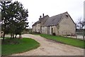
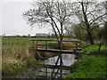
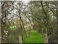
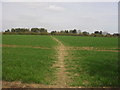
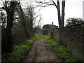
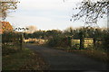
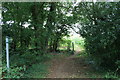
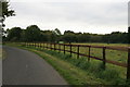
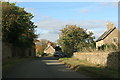
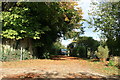
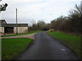
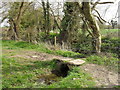
25 photos from this area
Area Information
Key information about the GL7 3LF including its size, population, and administrative classification.
- Area Type
- Postcode
- Area Size
- 21.1 hectares
- Population
- 1823
- Population Density
- 29 people/km²
House Prices in GL7 3LF
31
Properties
£698,967
Average Sold Price
£123,600
Lowest Price
£2,425,000
Highest Price
Showing 31 properties
| Address | Type | Beds | Baths | Last Sale Price | Last Sale Date | |
|---|---|---|---|---|---|---|
| Lockey House, Street Through Langford, Langford, GL7 3LF | Detached | 6 | 2 | £2,425,000 | Oct 2021 | |
| The Old Chapel, Street Through Langford, Langford, GL7 3LF | house | - | - | £335,000 | Feb 2021 | |
| 1, Lower Farm Cottages, Street Through Langford, Langford, GL7 3LF | house | 2 | - | £290,000 | Sep 2019 | |
| Belmont, Lechlade Road, Langford, GL7 3LF | Bungalow | 4 | 2 | £510,000 | Jun 2018 | |
| 3, Lower Farm Cottages, Street Through Langford, Langford, GL7 3LF | house | - | - | £262,000 | Jun 2013 | |
| Wren Barn, Street Through Langford, Langford, GL7 3LF | Cottage | 2 | 1 | £1,085,000 | Apr 2011 | |
| Vicarage, Street Through Langford, Langford, GL7 3LF | house | 5 | - | £1,325,000 | Jun 2010 | |
| Pember House, Street Through Langford, Langford, GL7 3LF | Detached | - | - | £1,250,000 | Nov 2006 | |
| Hardys Barn, Lechlade Road, Langford, GL7 3LF | Detached | 4 | 1 | £250,000 | Jun 2005 | |
| Bay Tree Cottage, Street Through Langford, Langford, GL7 3LF | Terraced | - | - | £350,000 | Jan 2002 |
Page 1 of 4
Energy Efficiency in GL7 3LF
Amenities
Schools
| Rank | School | Type | Entry gender | Ages |
|---|
Explore more schools in this area
Go to Schools tabDemographics
Household Size
Two person
most common
Accommodation Type
Houses
most common
Tenure
67
majority
Ethnic Group
White
most common
Religion
N/A
most common
Household Composition
N/A
most common
Age
47
median
Adults (30-64 years)
most common
Household Deprivation
N/A
with no deprivation
NS-SEC
42
in Lower managerial occupations
Explore more demographic insights in this area
Go to Demographics tabPlanning
Planning Constraints
- Flood RiskPremium
- Ramsar Wetland SitesPremium
- Area of Outstanding Natural BeautyPremium
- Protected Nature ReservePremium
- Protected WoodlandPremium