Area Overview for GL56 0SU
Photos of GL56 0SU
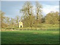
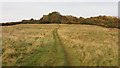

![Three ways to go [1] in GL56 0SU](https://images.propbar.co.uk/images/geograph/24/98/2498304_120.jpg)

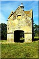
44 photos from this area
Area Information
Key information about the GL56 0SU including its size, population, and administrative classification.
- Area Type
- Postcode
- Area Size
- 1.2 km²
- Population
- 1435
- Population Density
- 59 people/km²
House Prices in GL56 0SU
25
Properties
£742,929
Average Sold Price
£512,500
Lowest Price
£1,000,000
Highest Price
Showing 25 properties
| Address | Type | Beds | Baths | Last Sale Price | Last Sale Date | |
|---|---|---|---|---|---|---|
| The Old Post Office, Road Through Chastleton, Chastleton, GL56 0SU | Semi-detached | 4 | 2 | £888,000 | Apr 2023 | |
| Home Farm Cottage, Road Through Chastleton, Chastleton, GL56 0SU | Semi-detached | 2 | 2 | £512,500 | Jul 2022 | |
| Harcomb House, Evenlode Lane, Chastleton, GL56 0SU | Semi-detached | 2 | 1 | £1,000,000 | Aug 2020 | |
| Greenmore, Road Through Chastleton, Chastleton, GL56 0SU | Semi-detached | - | - | £600,000 | Dec 2018 | |
| Elm Tree Cottage, The Lane, Chastleton, GL56 0SU | Detached | 5 | 2 | £615,000 | Jun 2009 | |
| Fox End, Road Through Chastleton, Chastleton, GL56 0SU | house | - | - | £680,000 | Jan 2004 | |
| Dower House, Road Through Chastleton, Chastleton, GL56 0SU | Detached | - | - | £905,000 | Aug 1999 | |
| Home Farm, Road Through Chastleton, Chastleton, GL56 0SU | Semi-detached | 2 | 2 | - | - | |
| 1, Harcombe Cottages, Evenlode Lane, Chastleton, GL56 0SU | house | - | - | - | - | |
| 2, Harcombe Cottages, Evenlode Lane, Chastleton, GL56 0SU | house | 2 | - | - | - |
Page 1 of 3
Energy Efficiency in GL56 0SU
Amenities
Schools
| Rank | School | Type | Entry gender | Ages |
|---|
Explore more schools in this area
Go to Schools tabDemographics
Household Size
Two person
most common
Accommodation Type
Houses
most common
Tenure
61
majority
Ethnic Group
White
most common
Religion
N/A
most common
Household Composition
N/A
most common
Age
47
median
Adults (30-64 years)
most common
Household Deprivation
N/A
with no deprivation
NS-SEC
37
in Lower managerial occupations
Explore more demographic insights in this area
Go to Demographics tabPlanning
Planning Constraints
- Flood RiskPremium
- Ramsar Wetland SitesPremium
- Area of Outstanding Natural BeautyPremium
- Protected Nature ReservePremium
- Protected WoodlandPremium