Area Overview for Garsington
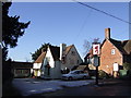
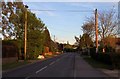
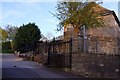
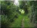
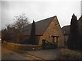
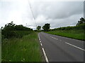
Photos of Garsington


Area Information
Garsington is a compact built-up area in England, spanning 59 hectares, with a population that reflects a mature demographic. Daily life here is shaped by its proximity to local amenities and transport links, making it practical for residents who value accessibility. The area’s character is defined by its blend of residential properties and nearby infrastructure, including retail outlets and rail connections. While the median age is 70, suggesting a community with a significant older population, the area still offers a range of services to support daily living. Garsington’s appeal lies in its balance of convenience and quietude, with nearby rail stations and a modest selection of shops within reach. For those considering living here, the low crime risk and established amenities provide a foundation for a stable, manageable lifestyle. The presence of a primary school underscores the area’s suitability for families, though the broader educational landscape remains limited to local institutions.
- Area Type
- Built Up Area 250
- Area Size
- 59.0 hectares
- Population
- Not available
- Population Density
- Not available
Garsington’s lifestyle is shaped by its proximity to retail outlets, including Spar, Lidl Cowley, and Morrisons Daily, which provide essential shopping options. The area also benefits from two rail stations, offering access to regional travel, and Chalgrove Airport, which could be useful for occasional air travel. While the data does not mention parks or leisure facilities, the presence of nearby shops and transport links suggests a functional, if modest, lifestyle. The limited range of amenities means residents may need to travel further for specialist services, but the area’s compact size ensures most daily needs are within reach.
Amenities
Schools
The nearest school to Garsington is the Garsington Church of England Primary School, which serves the local community. The data lists this school twice, but it is the only educational institution explicitly mentioned. As a primary school, it caters to younger children, but the absence of secondary schools or other educational facilities means families with older children may need to look beyond the immediate area. The single primary school suggests a limited educational ecosystem, which could be a consideration for households planning for long-term schooling needs.
| Rank | A + A* % | School | Type | Entry gender | Ages |
|---|---|---|---|---|---|
| 1 | N/A | Garsington Church of England Primary School | primary | N/A | N/A |
| 2 | N/A | Garsington Church of England Primary School | primary | N/A | N/A |
Explore more schools in this area
Go to Schools tabDemographics
The population of Garsington has a median age of 70, indicating a community skewed toward older adults. Home ownership is high, with 77% of residents owning their homes, suggesting a stable, long-term demographic. The data does not specify household composition or accommodation types, but the overall profile points to a settled population with fewer transient residents. The absence of detailed information on ethnic diversity or religious composition means the area’s cultural makeup remains unquantified. However, the lack of deprivation data implies that the community may not face significant socioeconomic challenges, though this cannot be confirmed. The age profile suggests a need for services tailored to older adults, such as healthcare and leisure facilities, which may influence the area’s infrastructure and social offerings.
Household Size
Accommodation Type
Tenure
Ethnic Group
Religion
Household Composition
Age
Household Deprivation
NS-SEC
Explore more demographic insights in this area
Go to Demographics tabPlanning
Planning Constraints
- Crime RiskLocked