Area Overview for Fulbrook
Photos of Fulbrook


Area Information
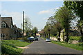
Fulbrook is a compact built-up area in England, covering 21.5 hectares. It is a place where older residents form a significant portion of the population, with a median age of 70. The area’s small size means amenities and services are within practical reach, creating a self-contained community. Living in Fulbrook offers access to essential retail outlets like Co-op Burford, Co-op Milton-U, and Co-op Centrum, which serve daily needs. Three railway stations—Shipton, Ascott, and Kingham—provide connectivity to nearby towns, while RAF Brize Norton nearby adds a layer of strategic significance. The area’s safety profile is reassuring, with a crime risk score of 70, indicating below-average crime rates. For those prioritising connectivity, Fulbrook scores highly for broadband, with a 97 out of 100, and mobile coverage rated 82. This makes it suitable for remote work and everyday internet use. The blend of practicality, safety, and accessibility positions Fulbrook as a viable choice for those seeking a quiet, well-served residential environment.
- Area Type
- Built Up Area 250
- Area Size
- 21.5 hectares
- Population
- Not available
- Population Density
- Not available
Residents of Fulbrook have access to a range of nearby amenities within practical reach. Three Co-op stores—Burford, Milton-U, and Centrum—provide essential retail services, from groceries to household items. The area’s railway stations offer easy access to regional travel, with Shipton, Ascott, and Kingham stations serving as key connectors. The presence of RAF Brize Norton nearby adds a unique element to the local landscape, though its impact on daily life is likely minimal for most residents. The combination of retail, transport, and strategic infrastructure creates a functional lifestyle, where convenience and accessibility are prioritised. While the area’s small size limits the diversity of leisure options, the proximity to essential services ensures a practical, low-stress environment for daily living.
Amenities
Schools
| Rank | A + A* % | School | Type | Entry gender | Ages |
|---|
Explore more schools in this area
Go to Schools tabDemographics
Fulbrook’s population skews older, with a median age of 70. This suggests a community where retirees and long-term residents predominate. Home ownership stands at 65%, reflecting a mix of owner-occupied properties and rental stock. The data does not specify household composition or accommodation types, but the overall figures indicate a stable, settled demographic. The area’s age profile may influence local services and amenities, with a focus on accessibility and healthcare proximity. While no specific diversity metrics are provided, the absence of detailed breakdowns means the community’s composition remains opaque. However, the high home ownership rate and older age demographic suggest a relatively cohesive, long-established population. This profile could appeal to buyers seeking a low-maintenance, mature neighbourhood with a clear sense of identity.
Household Size
Accommodation Type
Tenure
Ethnic Group
Religion
Household Composition
Age
Household Deprivation
NS-SEC
Explore more demographic insights in this area
Go to Demographics tabPlanning
Planning Constraints
- Crime RiskLocked