Area Overview for Frimley Green Ward
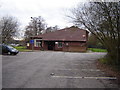
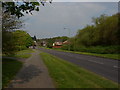
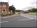
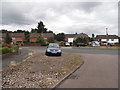
Photos of Frimley Green Ward
Area Information
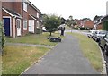
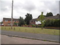
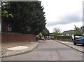
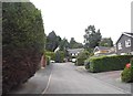
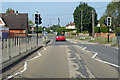
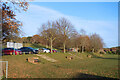
Frimley Green Ward stands as a distinct village and ward within the borough of Surrey Heath, covering an area of 2.6 square kilometres. This location lies one mile south of Frimley town and extends to thirty miles south-west of central London. The land slopes from Deepcut towards the River Blackwater while bordering Hampshire, creating a defined rural edge within the commuter belt. A population of 6,853 resides here, making it a substantial community compared to many English wards. The area gained its separate administrative identity in 1889 after establishing its first church, though the ward itself was formally created in 1965 to reflect 20th-century growth patterns. Daily life centres around the central village green, which gives the area its name and historical foundation. Playful amenities like the miniature railway at Frimley Lodge Park combine with the scenic Basingstoke Canal, which features a working wharf and inn. Historical residents such as composer Dame Ethel Smyth and figure skater Christopher Howarth connect this modern suburb to its deep roots. You can find the Lakeside Country Club on the edge of the ward, a venue that hosted the BDO World Darts Championship for many years. The ward sits just two miles from the M3 motorway, linking you rapidly to major job hubs without the isolation of the countryside. Living in Frimley Green Ward offers a blend of village simplicity and rapid access to the wider region.
- Area Type
- District Borough Unitary Ward
- Area Size
- 2.6 km²
- Population
- Not available
- Population Density
- Not available
Demographics
The community in Frimley Green Ward reflects a settled population with specific demographic characteristics. The median age sits at 70 years, indicating an older demographic than many urban areas. While the data labels the most common age range simply as "Age: Total", the high median suggests a significant number of older residents call this area home. In 2021, there were 2,266 households recorded in the ward during the 2011 census frame, showing a stable community structure. Home ownership is the dominant feature of the local housing scene, with 77 per cent of residents owning their property outright or with a mortgage. Only 47.1 per cent of these households were mortgaged in 2011, while 35.2 per cent owned their homes completely free of debt. This high ownership rate points to a stable, long-term resident base rather than a transient rental market. The ward reported 55.2 per cent of its population rating their health as very good in 2011, a figure that exceeded both national and local averages. Ethnic composition and religious affiliation data are not provided with specific breakdown figures in the available records. However, the homogeneity of the housing market suggests a traditionally established community. You can expect a neighbourhood where many people have spent decades raising families or enjoying retirement. The density of 6,853 people in just 2.6 square kilometres creates a close-knit environment where daily interactions often occur on local streets and village greens.
Household Size
Accommodation Type
Tenure
Ethnic Group
Religion
Household Composition
Age
Household Deprivation
NS-SEC
Explore more demographic insights in this area
Go to Demographics tabPlanning
Planning Constraints
- Flood RiskPremium
- Ramsar Wetland SitesPremium
- Area of Outstanding Natural BeautyPremium
- Protected Nature ReservePremium
- Protected WoodlandPremium
- Crime RiskPremium