Area Overview for Frilford
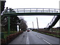
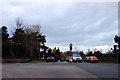
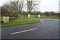
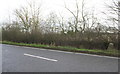
Photos of Frilford
Area Information
Frilford is a compact built-up area in England, covering 20.3 hectares. Its small size creates a tight-knit community feel, where daily life is shaped by proximity to essential services and local landmarks. The area’s median age of 70 suggests a population skewed towards older residents, which influences the character of the neighbourhood. Residents benefit from nearby amenities, including five retail outlets such as Budgens Frilford and Co-op Kingston, and three rail stations—Radley, Culham, and Appleford—offering easy access to surrounding towns. The presence of Josca’s Preparatory School, an independent institution, adds to the area’s appeal for families. With a safety score of 81, indicating low crime risk, Frilford offers a secure environment. Its blend of practical connectivity, modest retail options, and a relatively elderly demographic makes it distinct from larger urban centres. For those seeking a quieter, well-connected location with a focus on accessibility, Frilford provides a straightforward, no-frills lifestyle.
- Area Type
- Built Up Area 250
- Area Size
- 20.3 hectares
- Population
- Not available
- Population Density
- Not available
Frilford’s lifestyle is defined by its proximity to essential amenities. Five retail outlets, including Budgens Frilford and Tesco Abingdon, provide convenient shopping options for groceries and daily needs. The three nearby rail stations—Radley, Culham, and Appleford—offer easy access to surrounding areas, supporting both commuting and leisure travel. The area’s compact size means residents can reach these amenities on foot or by car within a short distance. While there is no mention of parks or recreational spaces in the data, the combination of retail, rail, and a low-crime environment creates a functional, accessible lifestyle. The presence of Josca’s Preparatory School adds to the area’s appeal for families, though the lack of other leisure facilities means residents may need to travel further for broader recreational opportunities.
Amenities
Schools
Frilford is served by Josca’s Preparatory School, an independent institution. This school is notable for its private education model, which may appeal to families seeking structured academic environments. However, the data does not provide Ofsted ratings or additional details about the school’s performance. The presence of a single independent school suggests limited diversity in educational options, though its proximity to the area makes it a practical choice for families. For those prioritising private education, Josca’s Prep is the primary local option, but parents should investigate further to assess its curriculum and facilities.
| Rank | School | Type | Entry gender | Ages |
|---|
Explore more schools in this area
Go to Schools tabDemographics
Frilford’s population is predominantly older, with a median age of 70. This suggests a community where retirees or long-term residents form the majority. Home ownership is high, at 75%, indicating a stable, owner-occupied environment rather than a rental market. The data does not specify household composition or accommodation types, but the overall figures suggest a mix of family and single-person households. The area’s demographic profile lacks detailed breakdowns of ethnicity or religion, but the 75% home ownership rate implies a settled population with long-term ties to the area. The absence of specific deprivation data means it is unclear how economic factors influence quality of life, though the low crime risk and access to rail services suggest reasonable living conditions.
Household Size
Accommodation Type
Tenure
Ethnic Group
Religion
Household Composition
Age
Household Deprivation
NS-SEC
Explore more demographic insights in this area
Go to Demographics tabPlanning
Planning Constraints
- Crime RiskPremium