Area Overview for Fratton Ward
Photos of Fratton Ward
Area Information
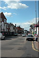
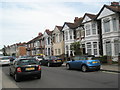
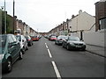
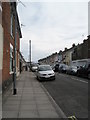
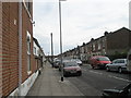
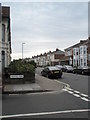
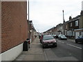
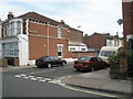
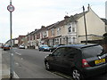
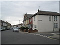
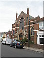
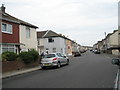
Fratton Ward stands as a central electoral district within Portsmouth City Council, situated on the heart of Portsea Island. This compact area spans 1.3 square kilometres yet accommodates a population of 3,217 residents, creating a dense living environment. The ward possesses a deep historical lineage, originating as the Saxon village of Froddington and appearing in the Domesday Book of 1086. Urban expansion accelerated in the late nineteenth century when terraced housing was constructed during the 1870s and 1880s as Portsmouth grew. You can still find evidence of this transformation today in the area's notable features, including the rebuilt St Mary's Church from 1889 and the historic Bridge Tavern pub dating back to 1868. Daily life here revolves around key local landmarks that define the neighbourhood's character. Fratton railway station, which opened in 1885, sits centrally within the ward and serves as a transport hub on the Portsmouth direct line. Nearby, the vast Fratton Park football stadium was constructed in 1899 alongside the Milton development and named after the original station. The area also traces its industrial roots to the former Portsmouth and Arundel Canal route, which now operates as a railway corridor. Living in Fratton Ward means accessing these historical assets alongside modern infrastructure, offering a blend of ancient village origins and developed urban convenience within a single borough unitary ward.
- Area Type
- District Borough Unitary Ward
- Area Size
- 1.3 km²
- Population
- 3217
- Population Density
- 2500 people/km²
Demographics
The community profile of Fratton Ward reflects a significant presence of older residents, with a median age of 70 years. This demographic skew indicates that the area is home to a large cohort of retirees or Generation Silver residents. Consequently, the prevailing household composition likely involves single-person households or multi-generational families rather than typical young professional setups. You will find that nearly half of the residents, approximately 48 per cent, own their homes outright. This ownership level suggests a community seasoned over several decades, where many families have remained in their properties for extended periods. The ward functions as a mature district where accommodation types will predominantly suit established residents. While specific breakdowns of apartment versus house ownership are not detailed in the local statistics, the high home ownership percentage points towards a stock of established dwellings rather than transient rentals. No specific data regarding religious affiliation or predominant ethnic groups is currently recorded for this ward, but the age profile remains the most distinct statistical marker for planning purposes. The density of 2,500 people per square kilometre creates a compact living experience where services are likely within short walking distances. When choosing homes near Fratton Ward, you are entering a neighbourhood defined by stability and an older population structure.
Household Size
Accommodation Type
Tenure
Ethnic Group
Religion
Household Composition
Age
Household Deprivation
NS-SEC
Explore more demographic insights in this area
Go to Demographics tabPlanning
Planning Constraints
- Flood RiskPremium
- Ramsar Wetland SitesPremium
- Area of Outstanding Natural BeautyPremium
- Protected Nature ReservePremium
- Protected WoodlandPremium
- Crime RiskPremium