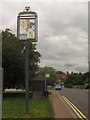
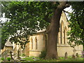
Area Overview for Fordcombe
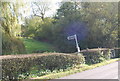
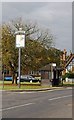
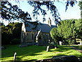
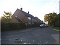
Photos of Fordcombe
Area Information
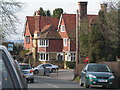
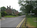
Living in Fordcombe offers a quiet, established presence in England’s landscape. Covering 31.1 hectares, it is a compact built-up area with a distinct character shaped by its older population. The median age of 70 suggests a community rooted in long-term residency, with 81% of homes owned outright. This reflects a stable, low-turnover environment where many residents have lived for decades. Daily life here is defined by proximity to essential services, including nearby rail stations and retail outlets. While the area lacks major urban hubs, its practical amenities and transport links make it accessible for commuting. The presence of Fordcombe Church of England Primary School underscores a focus on family needs, though secondary education options are not listed. Fordcombe’s safety profile is strong, with a crime risk score of 87, indicating a secure environment. However, broadband connectivity is a notable limitation, scoring 25, which may affect remote work or digital lifestyles. For those prioritising tranquillity and community over fast-paced convenience, Fordcombe provides a settled, low-maintenance alternative to busier towns.
- Area Type
- Built Up Area 250
- Area Size
- 31.1 hectares
- Population
- Not available
- Population Density
- Not available
Fordcombe’s lifestyle is shaped by its proximity to practical amenities. Retail options include Budgens Langington, Lidl Tunbridge, and Tesco St, providing everyday shopping convenience. The area’s rail and metro stations connect residents to nearby towns, enabling easy access to leisure, employment, and services beyond Fordcombe. While parks or recreational spaces are not explicitly listed in the data, the presence of multiple transport hubs suggests a balance between local convenience and regional opportunities. The community appears to prioritise accessibility over expansive leisure facilities, making it suitable for those who prefer a compact, service-oriented environment. For residents, daily life revolves around nearby shops, efficient transport, and a quiet, established setting.
Amenities
Schools
The nearest school to Fordcombe is Fordcombe Church of England Primary School, which serves the local community. As a primary school, it caters to younger children, though no secondary education options are listed in the data. This means families with older children may need to look beyond the immediate area for secondary schooling. The presence of a primary school indicates a focus on local education, but the absence of further details on its Ofsted rating or performance means parents must seek additional information independently. For those prioritising proximity to schools, Fordcombe’s primary institution is a practical asset, but the lack of secondary options may influence long-term housing decisions.
| Rank | School | Type | Entry gender | Ages |
|---|
Explore more schools in this area
Go to Schools tabDemographics
Fordcombe’s population is predominantly older, with a median age of 70. This suggests a community where long-term residents outnumber younger families, shaping a demographic profile that leans towards stability and familiarity. Home ownership is high, with 81% of properties owned by their occupants, reflecting a lack of rental activity and a preference for long-term investment. The data does not specify household composition or accommodation types, but the overall home ownership rate indicates a mature, low-mobility population. The absence of detailed information on ethnic diversity or religious composition means these aspects cannot be discussed further. The area’s age profile may influence local services, with a focus on healthcare and community support rather than schools or childcare facilities. For buyers, this demographic suggests a market where properties are likely to remain in the same hands for extended periods, offering predictable value retention.