Area Overview for Ford
Photos of Ford
Area Information
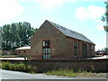
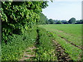
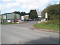
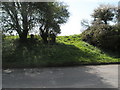
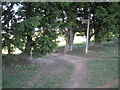
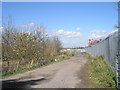
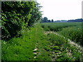
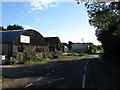
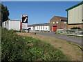
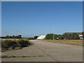
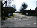
Ford is a civil parish located in the Arun District of West Sussex, England. You will find it situated approximately two miles south-south-west of Arundel, nestled alongside the River Arun. This village occupies a small footprint of just 4.2 square kilometres, yet it holds a deep historical significance dating back to the Saxon period. The settlement formed around a crossing point across the river that controlled an ancient coast road. Life in Ford revolves around its distinctive low-lying terrain, where the well-drained alluvial land slopes gently eastwards between two and seven metres above sea level. The area features a mix of historic charm and functional development. You can explore the grounds of the Grade I listed Church of Saint Andrew-by-the-Ford or visit the former airfield site which now hosts HM Prison Ford. The parish also borders the River Arun and lies close to the public track along the water. While the northern parts maintain a predominantly rural character with fertile agricultural land, the southern edge contains larger industrial units at the Rudford Industrial Estate. Whether you are looking at homes near the old railway station on the West Coastway Line or finding quiet spots by the river, Ford offers a setting defined by its historic roots and proximity to the coast road.
- Area Type
- Parish
- Area Size
- 4.2 km²
- Population
- Not available
- Population Density
- Not available
Demographics
The community profile in Ford is distinctly mature, with a median age of 70 years. This demographic indicates a settlement that serves principally as a retirement destination or a home for long-term residents. Age analysis confirms that the total population clusters heavily in the older age brackets, contrasting sharply with more dynamic suburban areas. House ownership stands high at 83%, suggesting a stable environment where most families have secured their base rather than renting. This high level of proprietorship shapes the local culture towards long-term commitment. The household composition reflects this static nature. You will find a community where residents are established rather than transient. The ethnic diversity metrics do not specify a single predominant group in the provided figures for the total population, meaning the area is likely a mix of backgrounds typical for the region. Religious statistics are also not specified for the total population, so you cannot assume a specific denomination dominates. In practical terms, the absence of young families or a large student cohort means local amenities cater less to active playgroups and more to the needs of established households. The 83% ownership rate remains the most significant indicator of the area's character, defining it as a place where people stay.
Household Size
Accommodation Type
Tenure
Ethnic Group
Religion
Household Composition
Age
Household Deprivation
NS-SEC
Explore more demographic insights in this area
Go to Demographics tabPlanning
Planning Constraints
- Flood RiskPremium
- Ramsar Wetland SitesPremium
- Area of Outstanding Natural BeautyPremium
- Protected Nature ReservePremium
- Crime RiskPremium