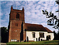
Area Overview for Finchampstead
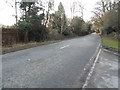
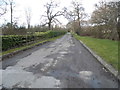
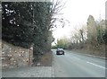
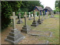
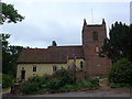
Photos of Finchampstead


Area Information
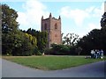
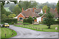
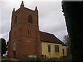
Finchampstead stands as a well-established built-up area within Berkshire, covering a landmass of 86 hectares. This sizeable footprint accommodates the local population while maintaining a distinct village character. The area does not suffer from the density pressures of larger urban centres, allowing residents to navigate their environment with comparative ease. Daily life here revolves around proximity to key infrastructure and established commercial hubs. You will find yourself surrounded by a community that has evolved over time, balancing historic roots with modern convenience. Living in Finchampstead means accessing a range of services without travelling far. The area functions as a practical residential hub rather than a detached rural plot. Nearby Crowthorne Railway Station, Sandhurst Railway Station, and Wokingham Railway Station provide robust rail links for commuters. Retail options such as Co-op Finchampstead and major supermarkets in Yateley are within practical reach. Blackbushe Airport sits nearby for those requiring aviation access. Homes in Finchampstead benefit from this strategic location, offering a blend of quiet living and accessible connectivity. The community feels grounded and accessible, avoiding the disconnection often felt in remote locations.
- Area Type
- Built Up Area 250
- Area Size
- 86.0 hectares
- Population
- Not available
- Population Density
- Not available
Daily lifestyle in Finchampstead revolves around practical amenities within easy reach. Retail options include Co-op Finchampstead for local daily needs. Residents also have access to larger supermarkets such as Waitrose Yateley and Sainsburys Yateley for more extensive shopping. These venues provide a comprehensive range of food and household goods without requiring a long journey. Rail connectivity remains a central pillar of your routine, with access to Crowthorne Railway Station, Sandhurst Railway Station, and Wokingham Railway Station. For those requiring private aviation, Blackbushe Airport sits nearby. The combination of these retail and transport nodes creates a convenient living environment. You can handle errands at Co-op Finchampstead or find specialised goods at the Yateley locations. The area supports a balanced lifestyle where major services are accessible yet integrated into a quieter residential setting. There is no need to travel far for groceries or socialising. The proximity of these establishments, including Waitrose and Sainsburys, ensures your daily requirements are met efficiently. This connectivity is essential for maintaining a high standard of living without urban congestion.
Amenities
Schools
Families considering Finchampstead have access to specific educational institutions with verified quality ratings. Finchampstead CofE VA Primary School operates within the area. Inspection data from Ofsted rates this primary school as good. This designation indicates a standard of education deemed satisfactory and effective by regulatory bodies. The availability of this primary option provides a clear starting point for younger children within the Finchampstead community. For parents planning their education routes, the presence of a primary school rated good offers a solid local option. The school sector here supports the needs of the local demographic. While secondary options are not listed in the immediate vicinity data, the primary provision ensures continuity for early schooling. Choosing Finchampstead for homes allows you to access a primary school that meets official quality standards. This specific data point, the good Ofsted rating, provides a tangible metric for evaluating the educational environment for your children.
| Rank | School | Type | Entry gender | Ages |
|---|
Explore more schools in this area
Go to Schools tabDemographics
The community profile of Finchampstead reveals a mature population. Data confirms that the median age for residents reaches 70 years. This figure indicates a neighbourhood where retired individuals and older adults form the core demographic. Consequently, daily interactions and community events likely cater to an older generation. The household composition reflects this demographic shift, stabilising the local economy and social fabric. Home ownership stands at an exceptionally high level of 86%. This statistic defines the area as a predominantly owner-occupied community rather than a rental market. Residents enjoy the security and stability that comes with owning their property. The high ownership rate suggests lower transient populations and established long-term neighbourhoods. Accommodation types align with this profile, prioritising dwellings suitable for established families or retirees. While specific details on ethnic diversity and religious affiliation are not quantified in the provided figures, the stability of the home ownership rate highlights a settled community. You are purchasing into an environment where people have put down roots for the long term. This demographic reality shapes the pace of life and the neighbourly interactions you will experience.