Area Overview for Fawkham
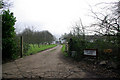
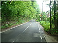
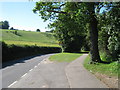
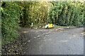
Photos of Fawkham
Area Information
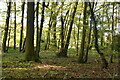
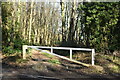
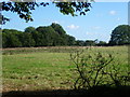
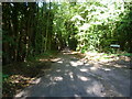
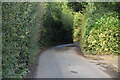
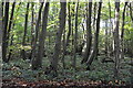
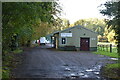
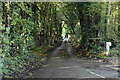
Fawkham is a small civil parish situated within the Sevenoaks District of Kent. This low-density, linear settlement stretches approximately three miles along the bottom of a dry chalk valley. You will find the area located on high ground among the North Downs hills, sitting just south of Longfield. The M20 motorway marks the south-east boundary, while the London to Chatham railway line runs along the north-east edge. With a total area size of 6.6 square kilometres, the village lacks a traditional commercial centre or high street. Instead, buildings cluster near the church at Castle Hill and around the green on Fawkham Green Road. The population stands at 429 residents across roughly 220 houses. This feels like a quiet, rural community rather than a bustling town. There is no discernible village centre to navigate, which shapes the daily rhythm of life here. The settlement defines itself as a hamlet by the local council. Its history extends back to the Stone Age, with a Norman family eventually adopting the name de Fawkeham during the reign of Henry I. The present church replaced a much older Saxon wooden structure around the early 12th century. As you explore the neighbourhood, you encounter specific landmarks that reflect this deep heritage. The Grade I listed parish church of St Mary remains a focal point. Ruins of the first manor house once stood at Church Meadow before demolition in the 1840s. A site of granite setts likely marks the location of the original village cross at Fawkham Street. Living in Fawkham means embracing a landscape defined by flinty chalk soil and open skies. The Baldwins Green Conservation Area covers part of the village, protecting these historic features. The community profile reveals an older demographic dominant in this parish. The median age for residents is 70 years old. This indicates that the area attracts or retains significantly older households compared to national averages. You are more likely to encounter retirees or established families than young professionals. Household composition data confirms this trends toward older age groups. Home ownership stands at 75 per cent of all households. This high figure suggests long-term residents have settled in the village for decades. Very few properties change hands frequently through the rental market. The majority of accommodation stock is therefore owned by those who live there. Diversity data indicates the predominant ethnic group forms the vast majority of the population. Religion statistics also reflect traditional regional patterns with specific faith groups present. There is no specific narrow age range highlighted as the single most common grouping, but the strong median points clearly toward senior living. You should expect a tranquil environment where neighbours know each other well. The low household turnover often seen in such areas supports this observation. Half the population falls into the older categories which drives the median up. When you look at the total accommodation types, owner-occupied properties clearly outnumber all other categories combined. This creates a stable residential fabric without the transient nature of student housing or shared flats. The character of the streets reflects this settled demographic. Services and amenities likely cater to the needs of this older population base. The 220 houses accommodate just over 400 people, keeping density very low. Living here means participating in a community defined by stability and age. The housing market in Fawkham is defined by a very high level of stability. You will find that 75 per cent of households are owner-occupied. This leaves just a quarter of the market as rented accommodation. The area predominantly consists of established homes held by their current residents. With around 220 houses spread across the 6.6 square kilometres, stock levels are naturally low. You are looking primarily at existing properties rather than new developments or rapid turnover. The lack of rental statistics suggests a rarefied market where sales are infrequent. Buyers entering this space should prepare for a unique inventory rather than a standard high-street search. Most homes in Fawkham are single properties or small clusters near the green. The median age of 70 hints at a stock built for earlier generations. Many properties may originally have been built by the Grandisons, Bryans, Whites or the Hohler family who once owned the estate. The first manor house ruins at Church Meadow remind viewers of the land's deep history. Buying a home here often involves acquiring heritage as well as a dwelling. Granite setts mark the original village cross location, suggesting planned streets in the past. The Baldwins Green Conservation Area means many homes are protected by planning constraints. This legacy of historic ownership influences current valuations and buyer expectations. If you seek a niche property market rather than a mass-market event, this parish fits that description. There are no large housing estates here. Instead you find individual homes scattered along a linear route. The low population of 429 restricts the variety of options available to you. Digital connectivity presents a mixed picture for residents of Fawkham. Broadband quality scores currently stand at 37 out of 100. This rates as poor to fair depending on the testing methodology you use. High-speed fibre access is likely limited within this rural hamlet. Mobile network coverage scores much better at 76 out of 100. You can rely on signal for personal devices and standard calls. The rural location on the North Downs naturally limits fixed-line infrastructure. Most people living in Fawkham will depend on mobile data for consumption. Streaming high-definition content may be inconsistent when the 3g or 4g switch fails. The London to Chatham railway line forms a physical boundary on the north-east. Longfield railway station sits nearby and served the area as Fawkham Station until 1961. The M20 motorway marks the south-east boundary, providing main road access to the south. A minibus service operated in 1962 under a licence held by Dr Heffernan. This historical transport link hints at past reliance on non-car travel. Today, most residents own vehicles to navigate the linear settlement. The bus route is no longer a primary daily link for commuting. Working from home faces specific challenges due to the broadband score. Remote working suitability depends on your tolerance for potential connection drops. Local transport links are sparse outside the immediate catchment of the station. The lack of a central village centre reduces demand for local transit services. Connectivity depends heavily on your reliance on fixed versus mobile infrastructure. Safety assessments reveal a landscape with clear environmental risks but manageable crime levels. The area carries a warning for crime risk with a score of 65 out of 100. Crime rates sit around the average for similar regions. Standard security precautions remain advisable for any household. You must lock up vehicles and act with normal vigilance. Flood risk assessments show a pass level with a very low score of 0. There is low flood risk coverage across the parish. Soil and geography do not predispose this area to water logging events. Ramsar wetland sites assessment also yields a pass level. No Ramsar wetland coverage exists within the 6.6 square kilometres. Planning constraints regarding nature reserves are minor. No protected nature reserve coverage touches the settlement boundaries. However, protected woodland does appear within the map at a score of 12.73. This warning indicates the presence of woods requiring conservation care. Area of Outstanding Natural Beauty status is absent from the parish. No AONB coverage limits planning restrictions to standard levels. The combination of low flood risk and average crime creates a generally safe profile. The main precautionary measure relates to the protected woodland and standard security. Historical exploration around Castle Hill and Church Meadow should remain pedestrian only. The lack of dedicated crime prevention orders simplifies life for new residents. Residents can expect a typical rural safety environment without exotic hazards. Planning freedom remains high except for the specific woodland protection zone. The parish council manages these risks with standard protocols. Living here involves accepting typical country living precautions rather than urban vigilance. What is the community feel like for someone moving to Fawkham? The community feel in Fawkham is defined by its small size and rural character. There are just 429 residents living in a population that skews older. The median age is 70 years old, suggesting a retirement or long-term settlement demographic. Around 75 per cent of residents own their homes rather than renting. There is no discernible village centre, so social hubs cluster near the church at Castle Hill or the public house at Fawkham Green Road. The settlement is linear instead of sprawling. You will find a stable neighbourhood with low household turnover. The Grade I listed church of St Mary serves as a historic focal point. The Baldwins Green Conservation Area protects much of the built environment. This creates a quiet, historic atmosphere rather than a modern social scene. Who currently lives in Fawkham and what are the housing patterns? The primary residents of Fawkham belong to an older generation. The median age of 70 indicates that families with young children are rare. Most accommodation is owner-occupied, making up three-quarters of the total stock. You will find around 220 houses spread across the 6.6 square kilometre area. There is no significant rental market influencing the community. The predominant ethnic group and religion statistics reflect local traditions common in Kent. The population is concentrated in clusters near the river valley bottom. Ownership stability means limited movement between properties. The first manor house ruins now lie at Castle Hill. This historical continuity shapes the housing stock. You are buying into a heritage landscape rather than a modern development. How good is the transport and internet connectivity for working remotely? Internet connectivity in Fawkham is adequate for basic use but not ideal for heavy digital work. The broadband quality score is 37 out of 100, which rates as poor to fair. Mobile coverage performs better at 76 out of 100. You can rely on mobile networks for communication. The London to Chatham railway line runs along the north-east boundary. Longfield railway station is nearby but carries the old name Fawkham. Traffic is influenced by the M20 motorway bordering the south-east. A minibus service operated historically but may not be current. Working from home requires patience with fixed-line speeds. Daily commuting requires a car due to the lack of a central bus hub. The linear layout makes driving practical for local trips. Is it safe to live in Fawkham regarding crime and environmental risks? Fawkham presents a generally safe environment with typical rural precautions. The crime risk score is 65 out of 100, placing it around the national average. Standard home security is sufficient. You do not need to worry about flooding as the risk score is zero. No Ramsar sites or Area of Outstanding Natural Beauty constraints affect building here. However, there is a warning for protected woodland with a score of 12.73. This indicates specific areas of conservation importance within the parish. The Grade I listed church and conservation areas limit some developments. You remain safe from natural disasters but must respect local heritage rules. The low population density contributes to a quiet and secure atmosphere.
- Area Type
- Parish
- Area Size
- 6.6 km²
- Population
- Not available
- Population Density
- Not available
Demographics
The community profile reveals an older demographic dominant in this parish. The median age for residents is 70 years old. This indicates that the area attracts or retains significantly older households compared to national averages. You are more likely to encounter retirees or established families than young professionals. Household composition data confirms this trends toward older age groups. Home ownership stands at 75 per cent of all households. This high figure suggests long-term residents have settled in the village for decades. Very few properties change hands frequently through the rental market. The majority of accommodation stock is therefore owned by those who live there. Diversity data indicates the predominant ethnic group forms the vast majority of the population. Religion statistics also reflect traditional regional patterns with specific faith groups present. There is no specific narrow age range highlighted as the single most common grouping, but the strong median points clearly toward senior living. You should expect a tranquil environment where neighbours know each other well. The low household turnover often seen in such areas supports this observation. Half the population falls into the older categories which drives the median up. When you look at the total accommodation types, owner-occupied properties clearly outnumber all other categories combined. This creates a stable residential fabric without the transient nature of student housing or shared flats. The character of the streets reflects this settled demographic. Services and amenities likely cater to the needs of this older population base. The 220 houses accommodate just over 400 people, keeping density very low. Living here means participating in a community defined by stability and age. The housing market in Fawkham is defined by a very high level of stability. You will find that 75 per cent of households are owner-occupied. This leaves just a quarter of the market as rented accommodation. The area predominantly consists of established homes held by their current residents. With around 220 houses spread across the 6.6 square kilometres, stock levels are naturally low. You are looking primarily at existing properties rather than new developments or rapid turnover. The lack of rental statistics suggests a rarefied market where sales are infrequent. Buyers entering this space should prepare for a unique inventory rather than a standard high-street search. Most homes in Fawkham are single properties or small clusters near the green. The median age of 70 hints at a stock built for earlier generations. Many properties may originally have been built by the Grandisons, Bryans, Whites or the Hohler family who once owned the estate. The first manor house ruins at Church Meadow remind viewers of the land's deep history. Buying a home here often involves acquiring heritage as well as a dwelling. Granite setts mark the original village cross location, suggesting planned streets in the past. The Baldwins Green Conservation Area means many homes are protected by planning constraints. This legacy of historic ownership influences current valuations and buyer expectations. If you seek a niche property market rather than a mass-market event, this parish fits that description. There are no large housing estates here. Instead you find individual homes scattered along a linear route. The low population of 429 restricts the variety of options available to you. Digital connectivity presents a mixed picture for residents of Fawkham. Broadband quality scores currently stand at 37 out of 100. This rates as poor to fair depending on the testing methodology you use. High-speed fibre access is likely limited within this rural hamlet. Mobile network coverage scores much better at 76 out of 100. You can rely on signal for personal devices and standard calls. The rural location on the North Downs naturally limits fixed-line infrastructure. Most people living in Fawkham will depend on mobile data for consumption. Streaming high-definition content may be inconsistent when the 3g or 4g switch fails. The London to Chatham railway line forms a physical boundary on the north-east. Longfield railway station sits nearby and served the area as Fawkham Station until 1961. The M20 motorway marks the south-east boundary, providing main road access to the south. A minibus service operated in 1962 under a licence held by Dr Heffernan. This historical transport link hints at past reliance on non-car travel. Today, most residents own vehicles to navigate the linear settlement. The bus route is no longer a primary daily link for commuting. Working from home faces specific challenges due to the broadband score. Remote working suitability depends on your tolerance for potential connection drops. Local transport links are sparse outside the immediate catchment of the station. The lack of a central village centre reduces demand for local transit services. Connectivity depends heavily on your reliance on fixed versus mobile infrastructure. Safety assessments reveal a landscape with clear environmental risks but manageable crime levels. The area carries a warning for crime risk with a score of 65 out of 100. Crime rates sit around the average for similar regions. Standard security precautions remain advisable for any household. You must lock up vehicles and act with normal vigilance. Flood risk assessments show a pass level with a very low score of 0. There is low flood risk coverage across the parish. Soil and geography do not predispose this area to water logging events. Ramsar wetland sites assessment also yields a pass level. No Ramsar wetland coverage exists within the 6.6 square kilometres. Planning constraints regarding nature reserves are minor. No protected nature reserve coverage touches the settlement boundaries. However, protected woodland does appear within the map at a score of 12.73. This warning indicates the presence of woods requiring conservation care. Area of Outstanding Natural Beauty status is absent from the parish. No AONB coverage limits planning restrictions to standard levels. The combination of low flood risk and average crime creates a generally safe profile. The main precautionary measure relates to the protected woodland and standard security. Historical exploration around Castle Hill and Church Meadow should remain pedestrian only. The lack of dedicated crime prevention orders simplifies life for new residents. Residents can expect a typical rural safety environment without exotic hazards. Planning freedom remains high except for the specific woodland protection zone. The parish council manages these risks with standard protocols. Living here involves accepting typical country living precautions rather than urban vigilance. What is the community feel like for someone moving to Fawkham? The community feel in Fawkham is defined by its small size and rural character. There are just 429 residents living in a population that skews older. The median age is 70 years old, suggesting a retirement or long-term settlement demographic. Around 75 per cent of residents own their homes rather than renting. There is no discernible village centre, so social hubs cluster near the church at Castle Hill or the public house at Fawkham Green Road. The settlement is linear instead of sprawling. You will find a stable neighbourhood with low household turnover. The Grade I listed church of St Mary serves as a historic focal point. The Baldwins Green Conservation Area protects much of the built environment. This creates a quiet, historic atmosphere rather than a modern social scene. Who currently lives in Fawkham and what are the housing patterns? The primary residents of Fawkham belong to an older generation. The median age of 70 indicates that families with young children are rare. Most accommodation is owner-occupied, making up three-quarters of the total stock. You will find around 220 houses spread across the 6.6 square kilometre area. There is no significant rental market influencing the community. The predominant ethnic group and religion statistics reflect local traditions common in Kent. The population is concentrated in clusters near the river valley bottom. Ownership stability means limited movement between properties. The first manor house ruins now lie at Castle Hill. This historical continuity shapes the housing stock. You are buying into a heritage landscape rather than a modern development. How good is the transport and internet connectivity for working remotely? Internet connectivity in Fawkham is adequate for basic use but not ideal for heavy digital work. The broadband quality score is 37 out of 100, which rates as poor to fair. Mobile coverage performs better at 76 out of 100. You can rely on mobile networks for communication. The London to Chatham railway line runs along the north-east boundary. Longfield railway station is nearby but carries the old name Fawkham. Traffic is influenced by the M20 motorway bordering the south-east. A minibus service operated historically but may not be current. Working from home requires patience with fixed-line speeds. Daily commuting requires a car due to the lack of a central bus hub. The linear layout makes driving practical for local trips. Is it safe to live in Fawkham regarding crime and environmental risks? Fawkham presents a generally safe environment with typical rural precautions. The crime risk score is 65 out of 100, placing it around the national average. Standard home security is sufficient. You do not need to worry about flooding as the risk score is zero. No Ramsar sites or Area of Outstanding Natural Beauty constraints affect building here. However, there is a warning for protected woodland with a score of 12.73. This indicates specific areas of conservation importance within the parish. The Grade I listed church and conservation areas limit some developments. You remain safe from natural disasters but must respect local heritage rules. The low population density contributes to a quiet and secure atmosphere.
Household Size
Accommodation Type
Tenure
Ethnic Group
Religion
Household Composition
Age
Household Deprivation
NS-SEC
Explore more demographic insights in this area
Go to Demographics tabPlanning
Planning Constraints
- Flood RiskPremium
- Ramsar Wetland SitesPremium
- Area of Outstanding Natural BeautyPremium
- Protected Nature ReservePremium
- Protected WoodlandPremium
- Crime RiskPremium