Area Overview for Faringdon
Photos of Faringdon


Area Information
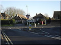
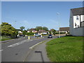
Faringdon is a built-up area situated in England with a distinct character defined by its small scale and intimate community feel. The residential zone covers only 2.1 km², a footprint that results in a population of 1,469 people. This yields a population density of 697 people per square kilometre, indicating a neighbourhood where residents are likely to know one another. Living in Faringdon means navigating a compact environment where daily necessities and local streets are in close proximity. You will find a setting that blends historic town centre experiences with a manageable residential layout. The town operates as a self-contained unit where the boundaries between open space and housing are clearly defined by its specific geographical limits. Prospective buyers looking for homes in Faringdon engage with a town that maintains its established identity rather than expanding rapidly. The area presents a straightforward proposition for those who value a clear sense of place over rapid urban growth.
- Area Type
- Built Up Area 250
- Area Size
- 2.1 km²
- Population
- 1469
- Population Density
- 697 people/km²
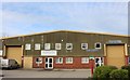
Daily life in Faringdon revolves around a compact set of amenities that are within practical reach of every home. The retail sector is keenly focused, with five notable shops serving the community. You will find Tesco Faringdon and Morrisons Daily providing your primary options for grocery shopping and daily essentials. Asda Acorn is also available nearby, offering a third major retailer. While the data specifies five shops, these three named venues represent the core of the shopping experience for anyone living in Faringdon. This concentration of supermarkets means you do not need to travel far for food or household necessities. The area functions efficiently without the need for long drives to find provisions. These named retail locations anchor the town centre, providing a consistent and reliable service for residents. The convenience factor is high given the small area size and the ability to access multiple major supermarket chains walking distance or a very short drive away.
Amenities
Schools
Families considering schools near Faringdon have access to a mixture of state and independent provisions within practical reach. The local area is supported by Faringdon Infant School, which serves younger children within the primary system. Faringdon Junior School complements this segment, providing education as a primary institution for older primary-age pupils. Both institutions are part of the core state education framework serving the town. Additionally, Faringdon Community College operates as a primary school, expanding the options available for compulsory education. For families seeking an independent alternative, Ferndale House Preparatory School offers a different educational environment outside the state sector. Parents also have access to Folly View Primary, which holds a 'good' Ofsted rating, providing independent verification of quality standards. This mix means you can choose between local state primary schools or the preparatory setting of Ferndale House. The presence of multiple primary-specific institutions indicates that Faringdon attracts families requiring education up to the age of 11 within the town limits.
| Rank | School | Type | Entry gender | Ages |
|---|
Explore more schools in this area
Go to Schools tabDemographics
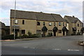
The community profile in Faringdon reflects a specific demographic reality centred on an older population. The median age reaches 70 years, marking the area as one predominantly served by older residents and retirees. While the data lists the most common age range simply as 'Age: Total', the high median figure confirms that younger families are a minority within this neighbourhood. Regarding household composition and accommodation types, the provided statistics cover totals but do not break down specific categories like single-person households or multi-generational living. However, the home ownership situation is clear and significant. Sixty-three per cent of residents own their homes outright or with a mortgage. This majority ownership suggests a settled population with strong local roots rather than a transient renting demographic. The area does not report specific data on predominant ethnic groups or religious affiliations, but the high ownership rate alongside the median age paints a picture of stability. You can expect a community where long-term residents hold the majority interest in the local housing stock.
Household Size
Accommodation Type
Tenure
Ethnic Group
Religion
Household Composition
Age
Household Deprivation
NS-SEC
Explore more demographic insights in this area
Go to Demographics tabPlanning
Planning Constraints
- Crime RiskPremium