Area Overview for Eynsford
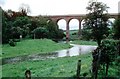
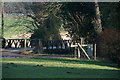
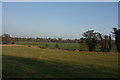
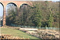
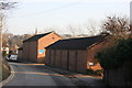
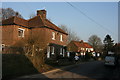
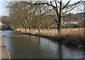
Photos of Eynsford


Area Information
Eynsford is a compact built-up area in England, spanning 80.4 hectares. Its population, while not quantified, reflects a community with a median age of 70, suggesting a demographic skewed towards older residents. Living here offers a quiet, established environment, with a focus on stability and long-term residency. The area’s size is modest, which may contribute to a close-knit feel, though it lacks the density of larger towns. Proximity to multiple railway stations—Eynsford, Swanley, and Farningham Road—connects residents to nearby towns and cities, enhancing accessibility. Daily life is shaped by local amenities, including retail outlets like Asda Swanley and Morrisons, and essential services. The presence of The Anthony Roper Primary School, rated ‘good’ by Ofsted, adds to the area’s appeal for families. Eynsford’s character is defined by its practicality, with a balance between residential tranquility and functional connectivity. For buyers seeking a low-maintenance, mature community with reliable transport links, it presents a straightforward choice.
- Area Type
- Built Up Area 250
- Area Size
- 80.4 hectares
- Population
- Not available
- Population Density
- Not available
Residents of Eynsford have access to essential retail amenities, including Asda Swanley, Morrisons Daily West Kingsdown 28, and Co-op West, all within practical reach. These stores provide everyday shopping convenience, from groceries to household items. The area’s railway stations connect to broader networks, enabling access to leisure, dining, and cultural opportunities beyond Eynsford. While the data does not specify parks or recreational facilities, the proximity to rail links suggests residents can easily reach green spaces or entertainment venues in nearby towns. The combination of local retail and transport links creates a lifestyle that balances practicality with connectivity. For those valuing self-sufficiency and ease of access, Eynsford offers a functional, if modest, array of amenities.
Amenities
Schools
The Anthony Roper Primary School is the only named school near Eynsford, offering primary education with an Ofsted rating of ‘good’. This single school suggests a limited range of educational options for families, though its ‘good’ rating indicates acceptable standards. The absence of secondary schools in the data means parents may need to look beyond Eynsford for older children’s education. For families prioritising primary schooling, The Anthony Roper Primary School provides a reliable option, but those requiring a full range of educational facilities may find the area’s offerings insufficient. The school’s rating and proximity to the area make it a key consideration for buyers with young children.
| Rank | School | Type | Entry gender | Ages |
|---|
Explore more schools in this area
Go to Schools tabDemographics
Eynsford’s population has a median age of 70, with the most common age range encompassing all ages. This suggests a community where older residents form a significant proportion, potentially influencing local services and social dynamics. Home ownership is high at 80%, indicating a stable, long-term resident base. Accommodation types and household compositions are not specified, but the data implies a mix of housing stock. The area’s predominant ethnic group and religious makeup are not detailed, though the figures provided suggest a broad demographic scope. The high home ownership rate may correlate with a lower turnover of residents, fostering a sense of continuity. However, the absence of specific data on deprivation or diversity means the full picture of quality of life remains partially obscured. For buyers, the age profile and ownership rates highlight a community prioritising stability over rapid change.