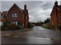
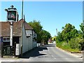
Area Overview for Eye and Dunsden
Photos of Eye and Dunsden


Area Information
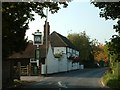
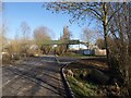
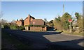
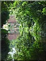
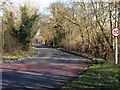
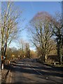
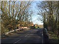
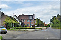
Living in Eye and Dunsden places you within a civil parish in the South Oxfordshire district, covering an area of 10.4 square kilometres. This rural community lies in the South East region of England, situated on the Thames floodplain where agriculture and former gravel pits dominate the landscape. The parish includes the hamlets of Sonning Eye and Dunsden, positioned approximately five miles south-south-west of Henley. Historical depth defines the area, stretching back to the Domesday Book under the name Dunesdene, with the civil parish formally created in 1894. You find notable landmarks such as the All Saints Church, built in 1842, and the historic Eye and Dunsden Village Hall, which dates its foundation to 1869. The local environment supports walkers and horse riders through public rights of way that link to neighbouring areas and Reading. Residents often connect with local history at the Dunsden Owen Association, which in memory of WW1 poet Wilfred Owen. Your daily life revolves around quiet hamlets rather than a central chapel, with the Thames Path offering access to water sports hubs like the Thames and Kennet Marina. This setting provides a clear distinction from the bustling towns nearby, offering a secluded experience amidst South Oxfordshire.
- Area Type
- Parish
- Area Size
- 10.4 km²
- Population
- Not available
- Population Density
- Not available
Demographics
The community in Eye and Dunsden reflects a settled population with a distinct age profile. The median age here is 70 years, indicating a resident base heavily weighted towards older adults. This demographic reality aligns with a home ownership rate of 70%, suggesting that the majority of residents have purchased their properties and likely intend to stay for the long term. You do not find a high concentration of young families or transient workers in this parish. Population data points to a total of around 366 residents based on the 2011 census, a figure likely similar today given the slow growth of this small rural settlement. The area functions as a residential enclave rather than a mixed-use district, with housing stock designed for permanent living rather than short-term stays. While specific breakdowns of household composition and accommodation types are not detailed in current records, the high ownership percentage implies a stable domestic structure. Diversity information is limited to the general total category provided in the data, meaning you should assume a relatively homogenous or low-diversity population typical of older rural parishes. This demographic stability means local services cater to the needs of mature residents rather than a youthful or working-age majority.
Household Size
Accommodation Type
Tenure
Ethnic Group
Religion
Household Composition
Age
Household Deprivation
NS-SEC
Explore more demographic insights in this area
Go to Demographics tabPlanning
Planning Constraints
- Flood RiskPremium
- Ramsar Wetland SitesPremium
- Area of Outstanding Natural BeautyPremium
- Protected Nature ReservePremium
- Protected WoodlandPremium
- Crime RiskPremium