Area Overview for Ewell Village Ward
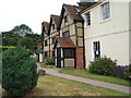
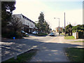
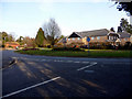
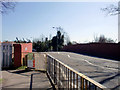
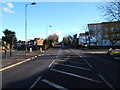
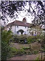
Photos of Ewell Village Ward


Area Information
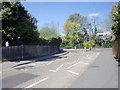
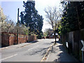
Ewell Village Ward sits within the Epsom and Ewell borough in Surrey. You will find this ward just outside the administrative boundary of Greater London, yet it remains entirely inside the M25 motorway. The location spans 1.3 km² of territory. This ward forms part of the town of Ewell, which includes the suburb of Ewell Court. A small portion of Cheam, specifically the eastern part of Nonsuch Park, adjoins the eastern edge of the borough. The ward is one of fifteen electoral wards established after a borough electoral review finalised in November 2022. Living in Ewell Village Ward means you are positioned close to Gatwick Airport, which lies approximately 20 miles south. Railway stations such as Ewell East, Ewell West, and Stoneleigh service the broader borough. All these stations accept Oyster cards for payment. Most stations fall into fare zone 5 or 6, except for Epsom itself. The coordinates place the area firmly in south-east England. This setting offers direct access to the motorway network while retaining a relationship with the wider London transport system. You gain proximity to a mix of suburban residential areas and parkland edges. The ward reflects a balanced neighbourhood within a district that holds borough status.
- Area Type
- District Borough Unitary Ward
- Area Size
- 1.3 km²
- Population
- Not available
- Population Density
- Not available
Demographics
The community in Ewell Village Ward reflects a settled population with a median age of 70. This figure indicates you will encounter an area where older residents constitute a significant portion of the demographic profile. The ward contains 71% owner-occupied homes, suggesting a strong preference for securing property ownership rather than renting. You are likely to meet neighbours who have lived in these homes for extended periods. The household composition data presents as "total", indicating aggregated figures available for the ward. Accommodation type information is similarly listed as "total" without further breakdown. Ethnicity and religion data appear only as "total" descriptors in the provided records. The most common age range is simply noted as "Age: Total" without a specific breakdown of decades. You can infer a stable, quieter community from the high home ownership rate and advanced median age. These demographics suggest families have already moved on to retirement settings or the ward attracts mature buyers seeking established properties. The area does not target young professionals or transient populations based on these hard statistics. Instead, the environment caters to those seeking long-term stability. The population spread suggests a low influx of new residents each year. This profile supports a calm daily life with fewer families dependent on early education services within the immediate ward boundary.
Household Size
Accommodation Type
Tenure
Ethnic Group
Religion
Household Composition
Age
Household Deprivation
NS-SEC
Explore more demographic insights in this area
Go to Demographics tabPlanning
Planning Constraints
- Flood RiskPremium
- Ramsar Wetland SitesPremium
- Area of Outstanding Natural BeautyPremium
- Protected Nature ReservePremium
- Protected WoodlandPremium
- Crime RiskPremium