Area Overview for Everton (New Forest)
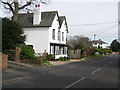
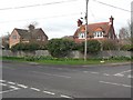
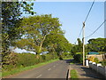
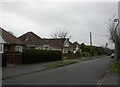
Photos of Everton (New Forest)


Area Information
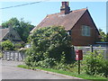
Everton (New Forest) is a small built-up area of 64.2 hectares, nestled in the heart of the New Forest National Park. Its proximity to natural landscapes and historic sites makes it a quiet, low-density community. With a median age of 70, the area is home to a predominantly older population, many of whom have lived here for decades. Daily life here is defined by a relaxed pace, with easy access to nearby towns like Lymington and the coastal resorts of the Isle of Wight. The area’s compact size means most amenities are within walking distance, while transport links to larger cities like Southampton and Bournemouth are well-established. Residents benefit from a mix of rural tranquillity and practical connectivity, with nearby ferry terminals and rail stations offering regular services. For those seeking a peaceful yet accessible lifestyle, Everton (New Forest) offers a unique blend of natural beauty and community stability, though its demographic profile suggests a focus on long-term residents rather than a rapidly growing population.
- Area Type
- Built Up Area 250
- Area Size
- 64.2 hectares
- Population
- Not available
- Population Density
- Not available
Living in Everton (New Forest) offers a blend of practical amenities and scenic surroundings. Within reach are five retail outlets, including Spar, The Southern Co-operative Co, and Tesco South, providing daily essentials. The area’s transport links extend to three ferry terminals, such as Lymington Town Quay, which connect to the Isle of Wight, and five rail stations, including Lymington Pier and Sway, facilitating travel to nearby cities. While the data does not specify parks or leisure facilities, the proximity to the New Forest National Park suggests outdoor activities are readily available. The presence of multiple retail and transport hubs indicates a community focused on convenience, with services tailored to a mature population. This setup supports a lifestyle that prioritises accessibility, whether for shopping, commuting, or exploring the surrounding natural landscapes.
Amenities
Schools
| Rank | A + A* % | School | Type | Entry gender | Ages |
|---|
Explore more schools in this area
Go to Schools tabDemographics
Everton (New Forest) has a median age of 70, indicating a predominantly older population. This age profile suggests a community where retirement is the primary life stage, with many residents likely to have lived in the area for extended periods. Home ownership is high, at 86%, reflecting a stable housing market and a preference for long-term residency over rental properties. The data does not specify household composition or accommodation types, but the overall figures suggest a population that is largely self-contained, with limited reliance on external services. The absence of detailed information on diversity or deprivation means the area’s social fabric remains opaque, but the high home ownership rate implies a sense of permanence and community cohesion. For prospective buyers, this demographic profile may indicate a market where properties are held for the long term, with fewer short-term rental pressures.
Household Size
Accommodation Type
Tenure
Ethnic Group
Religion
Household Composition
Age
Household Deprivation
NS-SEC
Explore more demographic insights in this area
Go to Demographics tabPlanning
Planning Constraints
- Crime RiskLocked