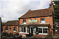
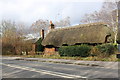
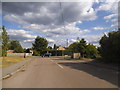
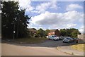
Area Overview for Evendons Ward
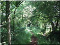
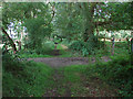
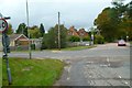
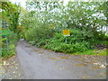
Photos of Evendons Ward
Area Information
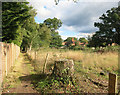
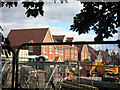
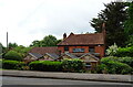
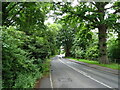
Living in Evendons Ward offers a distinct experience within the Wokingham borough of Berkshire. You are dealing with a compact residential unit spanning just 4.2 square kilometres, which defines a tightly knit local environment. The ward functions as a specific electoral boundary in the South East of England, situated at approximately 51.40°N latitude and 0.86°W longitude. Its small physical size means that daily life often revolves around immediate neighbours and local pockets rather than vast stretches of land. This geography creates a contained community where residents interact frequently with one another. The area serves as a practical example of a standard district borough unitary ward, blending suburban convenience with the constraints of a limited footprint. When you consider homes in Evendons Ward, you are entering a defined zone that operates under specific local governance structures. The ward's compact nature ensures that everything from local amenities to community events remains within close reach. It is a place where the scale of the neighbourhood is manageable, avoiding the sprawl found in larger districts.
- Area Type
- District Borough Unitary Ward
- Area Size
- 4.2 km²
- Population
- Not available
- Population Density
- Not available
Demographics
The community in Evendons Ward presents a clear demographic profile dominated by older residents. You will find that the median age sits at 70 years, indicating a population primarily composed of retirees and senior citizens. Most households fall into the age range associated with this median figure, shaping a quiet social fabric. With home ownership standing at 80 per cent, the area reflects a settled population rather than transient renters. This high level of tenure stability suggests long-term residents who have built their lives in the ward. Household composition data confirms this pattern, showing a total profile that aligns with the ageing median. Accommodation types follow suit, reflecting the needs of a mature demographic. While specific details on predominant ethnic groups and religious affiliations are not granularly broken out in the current dataset, the overall social structure points toward a homogenous community interested in peace and security. This profile means that local businesses and services typically cater to the lifestyle and spending power of an older, wealthier demographic. Parents with young children do not feature prominently, so schools near the area might see different attendance dynamics compared to other wards.
Household Size
Accommodation Type
Tenure
Ethnic Group
Religion
Household Composition
Age
Household Deprivation
NS-SEC
Explore more demographic insights in this area
Go to Demographics tabPlanning
Planning Constraints
- Flood RiskPremium
- Ramsar Wetland SitesPremium
- Area of Outstanding Natural BeautyPremium
- Protected Nature ReservePremium
- Protected WoodlandPremium
- Crime RiskPremium