Area Overview for Emmbrook Ward
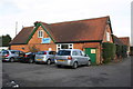
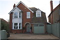
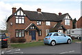
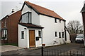
Photos of Emmbrook Ward
Area Information
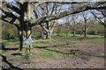
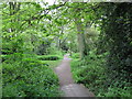
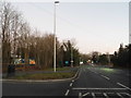
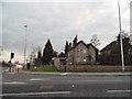
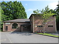
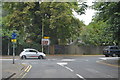
Living in Emmbrook Ward offers a defined suburban experience within the town of Wokingham, Berkshire. This electoral ward covers an area size of 3.1 km² and serves as a distinct district borough unitary ward. The location sits approximately 51.4228°N 0.8542°W, named after the Emm Brook, a tributary of the River Loddon. You will find local amenities concentrated along Reading Road, including shops, an Indian restaurant, and a post office. Three pubs serve the neighbourhood, specifically The Dog and Duck, The Rifle Volunteer, and The Emmbrook Inn. Community facilities include a village hall and two social centres. Sports clubs such as Wokingham & Emmbrook FC and Emmbrook & Bearwood Cricket Club operate within the area. Parks like Joel Park, named after local landowner Solomon Joel, Holt Copse, and Old Forest Meadows provide green spaces for residents. The 1st Emmbrook Scout Troop operates from Hedley Hall. This ward balances residential density with established community infrastructure, offering everything from a small business park to primary education needs directly within your daily route.
- Area Type
- District Borough Unitary Ward
- Area Size
- 3.1 km²
- Population
- Not available
- Population Density
- Not available
Demographics
The community profile of Emmbrook Ward reveals a predominantly older population. The median age for residents is 70, indicating a settlement that accommodates a significant number of senior citizens. Household composition and accommodation type data from the total records do not specify exact breakdowns beyond this key demographic metric. However, the area shows a strong preference for self-sufficiency, with a home ownership rate of 79%. This high percentage suggests that the majority of families and individuals in this ward own their property outright or have significant equity. The predominant ethnic group, religion, and specific household composition details are recorded as total categories in the available data, meaning specific granularity for these aspects is not available. Despite the general absence of specific diversity or detailed household type statistics, the high ownership rate points towards a stable resident base. This demographic reality shapes local demand for single-level living and accessibility features, which are critical considerations when you look at specific homes in Emmbrook Ward.
Household Size
Accommodation Type
Tenure
Ethnic Group
Religion
Household Composition
Age
Household Deprivation
NS-SEC
Explore more demographic insights in this area
Go to Demographics tabPlanning
Planning Constraints
- Flood RiskPremium
- Ramsar Wetland SitesPremium
- Area of Outstanding Natural BeautyPremium
- Protected Nature ReservePremium
- Protected WoodlandPremium
- Crime RiskPremium