Area Overview for Elson Ward
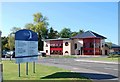
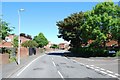
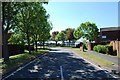
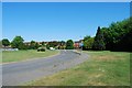
Photos of Elson Ward

Area Information
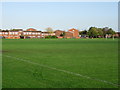
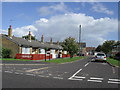
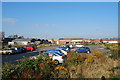
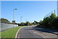
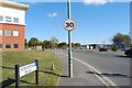
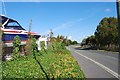
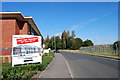
Living in Elson Ward offers a defined perspective of life along the southern coast of England. This district forms an electoral ward within the Gosport Borough Council in Hampshire, located on the northern side of Portsmouth Harbour directly opposite the naval base. The area covers 2.5 km², making it a compact neighbourhood where local amenities are within easy reach. You will find historical significance here, as the ward contains Fort Elson, one of the early Palmerston forts constructed between the 1850s and 1860s. This fort stands as part of Gosport's polygonal land fort defence line, adding a layer of historical weight to the local landscape. Daily life in Elson unfolds alongside major transport arteries, including the A32, M275, and M27. These roads provide access to the wider region and connect residents to vehicle ferry links across the harbour. Nearby suburbs such as Hardway, Bridgemary, and Rowner form the immediate adjacent context for everyday movement. While specific journey times to national hubs are not detailed in local records, the proximity to stations like Portsmouth Harbour and Cosham suggests strong regional connectivity. The area also hosts Elson Library and sits close to Pewit Island, a small islet within the harbour, and Fort Brockhurst, which is managed by English Heritage. Understanding the layout and history of Elson Ward is essential for anyone considering homes in this part of Gosport.
- Area Type
- District Borough Unitary Ward
- Area Size
- 2.5 km²
- Population
- Not available
- Population Density
- Not available
Demographics
The community profile of Elson Ward reveals a settlement with an older demographic character. The median age for residents is 70, indicating that the population skews significantly towards the elderly. While the data does not specify a single age range as most common, the overall age profile alongside the median figure suggests a neighbourhood favoured by retirees or long-term residents in their later years. This age distribution often influences local service demand and the general pace of community life. Home ownership is the dominant form of tenure in the area, with 75% of households owning their homes outright or with a mortgage. This high percentage contrasts sharply with rental markets found in university towns or major city centres. The high level of home ownership typically points to a stable community where families and individuals have deep roots in the locality. You will find that the accommodation types reflect this ownership pattern, likely consisting of detached and semi-detached houses suited to family living or retirement needs. Although specific data on ethnic groups, religion, and detailed household composition totals are not broken down further, the high ownership rate and age profile paint a picture of established residents who have chosen to settle in Elson Ward for its long-term security and quiet character rather than transient living conditions.
Household Size
Accommodation Type
Tenure
Ethnic Group
Religion
Household Composition
Age
Household Deprivation
NS-SEC
Explore more demographic insights in this area
Go to Demographics tabPlanning
Planning Constraints
- Flood RiskPremium
- Ramsar Wetland SitesPremium
- Area of Outstanding Natural BeautyPremium
- Protected Nature ReservePremium
- Protected WoodlandPremium
- Crime RiskPremium