Area Overview for Ellisfield
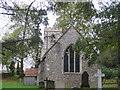
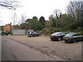
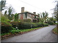
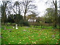
Photos of Ellisfield
Area Information
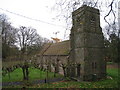
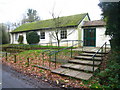
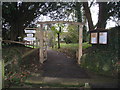
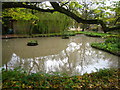
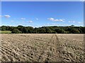
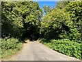
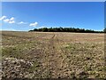
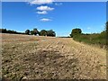
Living in Ellisfield offers a distinct experience within a small civil parish covering 9.5 square kilometres. This rural setting presents itself as a place where daily life moves at a measured pace, far removed from the congestion of major urban centres. Prospective homebuyers should consider that this area is defined by its compact size and strong sense of local independence. You will find a community that prioritises stability over rapid change, making it a sensible choice for those seeking a quiet retreat. The location provides a straightforward living arrangement without the complications often found in larger towns or developing suburbs. When you choose homes in Ellisfield, you are entering a space where the built environment respects the natural landscape. The parish functions as a self-contained unit, meaning many of your daily needs can be met locally. This setup suits individuals who value efficiency alongside tranquillity. You do not have to look far for the grocer or the local shop. The area delivers a practical lifestyle focused on simplicity. It is a place where the routine of daily life remains predictable and manageable. For those considering Ellisfield, the primary draw is the combination of space and low-density living. You gain access to a neighbourhood that does not suffer from overcrowding or excessive noise. The sheer size of just 9.5 km² ensures that distances between key locations remain short. This makes it an ideal environment for retirees or remote workers who require peace and reliable infrastructure. You gain a residential experience characterised by openness and clear skies.
- Area Type
- Parish
- Area Size
- 9.5 km²
- Population
- Not available
- Population Density
- Not available
Demographics
The community profile of Ellisfield reflects a settled population with clear characteristics. The median age stands at 70 years, indicating that the area attracts residents in their later years. Most common age groups centre on senior demographics, suggesting a strong retirement presence. This demographic skew influences the local culture and the pace of life. You will encounter neighbours who have often lived in the parish for decades, creating deep-rooted local connections. Home ownership levels reach 55% in Ellisfield, placing this parish above the national average for eigen-occupation. This figure reveals a market where people prefer to remain in their family homes or purchase properties for long-term stays. You are more likely to find homeowners than tenants walking down the street. This high rate of ownership fosters stability and reduces transient populations. The accommodation types generally align with the needs of an older demographic, favouring detached or semi-detached structures over high-rise flats. The household composition in Ellisfield mirrors the age data, with fewer young families and more single-person or elderly couples. This configuration means local schools near Ellisfield will not see the same pressure or demand as in urban districts. The ethnic and religious diversity data remains consistent with general patterns for such a specific rural parish, reflecting a homogeneous community structure. Deprivation levels do not appear to be a factor given the strong home ownership and low crime figures. You live here in a context of financial security and social continuity rather than rapid demographic shifts.
Household Size
Accommodation Type
Tenure
Ethnic Group
Religion
Household Composition
Age
Household Deprivation
NS-SEC
Explore more demographic insights in this area
Go to Demographics tabPlanning
Planning Constraints
- Flood RiskPremium
- Ramsar Wetland SitesPremium
- Area of Outstanding Natural BeautyPremium
- Protected Nature ReservePremium
- Protected WoodlandPremium
- Crime RiskPremium