Area Overview for Egham Town Ward
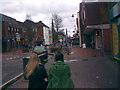
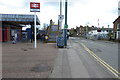
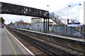
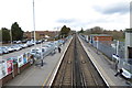
Photos of Egham Town Ward
Area Information
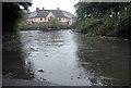
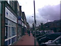
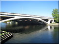
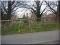
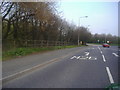
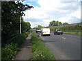
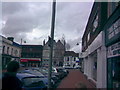
Living in Egham Town Ward means residing in a compact suburban district that forms the central heart of Egham. This electoral ward lies within the Runnymede Borough Council area and covers an area of just 2.9 km². Despite its small footprint, the ward supports a population of 1,538 residents. The location places you approximately 19 miles west-southwest of central London, establishing it as a key node in the South East region. You are positioned just west of the M25 motorway, accessible via junction 13. South Western Railway services connect you from London Waterloo to Reading through Egham railway station, which opened in 1856. The ward includes sections of the town centre and neighbours notable historical sites such as the Magna Carta Memorial at Runnymede. The area predates 666 AD and appears in the Domesday Book of 1086 as Egeham. This deep history underpins the modern character of the ward, which blends historic significance with contemporary commuter convenience. The campus of Royal Holloway, University of London sits within one mile of the town centre. You benefit from immediate access to town amenities while maintaining a distance from the congested outskirts of the capital. The ward functions as a practical home base for those seeking a connection to London without the density of the inner suburbs. Its location allows for straightforward travel to Reading, where you can find the Air Forces Memorial at Englefield Green. The combination of historic estates and modern transport links defines daily life here.
- Area Type
- District Borough Unitary Ward
- Area Size
- 2.9 km²
- Population
- 1538
- Population Density
- 536 people/km²
Demographics
The community in Egham Town Ward reflects a mature demographic profile with a median age of 70 years. This statistic indicates a population that skews significantly older than the national average. You are likely to encounter neighbours who have lived in the area for decades or who plan to remain for many more years. The ward contains 1,538 residents concentrated across 2.9 km², resulting in a population density of 536 people per km². Home ownership stands at 51%, meaning slightly more than half of the households have purchased their properties. This figure suggests a stable environment where residents are likely invested in their local streets and streetscapes. Accommodation types in the broader ward area include 836 flats, alongside 438 terraced homes, 932 semi-detached homes, and 500 detached homes. The high proportion of older residents aligns with the presence of significant flat stock and one-story housing often found in town wards. These housing forms typically offer single-level living, which suits the age profile of the population. The household composition leans towards those requiring accessible properties or smaller living spaces. You do not face the transient nature of students or young professionals as the primary housing demographic. Instead, the community feels established and settled. The age distribution shows that the total age group represents the most common range within the local statistics. This demographic reality shapes the pace of daily life and the typical needs of the residents.
Household Size
Accommodation Type
Tenure
Ethnic Group
Religion
Household Composition
Age
Household Deprivation
NS-SEC
Explore more demographic insights in this area
Go to Demographics tabPlanning
Planning Constraints
- Flood RiskLocked
- Ramsar Wetland SitesLocked
- Area of Outstanding Natural BeautyLocked
- Protected Nature ReserveLocked
- Protected WoodlandLocked
- Crime RiskLocked