Area Overview for Egham Hythe Ward
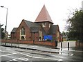
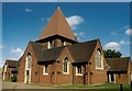
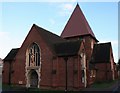
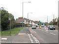
Photos of Egham Hythe Ward


Area Information
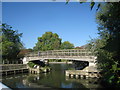
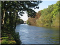
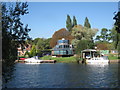
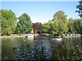
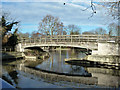
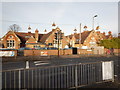
Egham Hythe Ward sits approximately 18 miles west of central London, forming part of the Borough of Runnymede in Surrey. This small district covers just 1.9 square kilometres and lies on the south bank of the River Thames. You will find it bordered by the M25 motorway to the north, which separates you from the town of Egham, and the River Thames to the south, leading towards Staines-upon-Thames. The ward comprises adjacent settlements including Pooley Green and Thorpe Lea. Historically, this area was part of the ancient parish of Egham, appearing in the Domesday Book as Egeham. The local landscape includes the riverside conservation area known as the Hythe, which features a large inn and hotel. Staines Bridge provides a local road crossing over the river, linking the ward to the Thames Path. Living in this location means dealing with significant geographical constraints defined by major infrastructure and waterways. The area retains historical significance, with the local Egham Rural District created in 1894 before being replaced in 1906. The ward's designation as a conservation area highlights its preserved character within the South East region.
- Area Type
- District Borough Unitary Ward
- Area Size
- 1.9 km²
- Population
- Not available
- Population Density
- Not available
Demographics
The community in Egham Hythe Ward reflects an older population structure. The median age stands at 70 years, indicating that the most common age group among residents is senior citizens. Nearly six in ten households own their property, with a home ownership rate of 59%. This high level of ownership suggests a stable settlement pattern rather than a transient rental market. You will not find detailed breakdowns of household composition, predominant ethnic groups, or religious affiliations in the current records for this ward. The lack of specific data on these demographic strands prevents a full picture of the social diversity. However, the age profile alone suggests a quieter residential environment dominated by retired residents. With such an older demographic, the daily life in Egham Hythe likely revolves around leisure, community engagement, and established routines. The absence of younger family clusters in the available statistics paints a picture of a mature neighbourhood. Prospective buyers should be aware that the social fabric is shaped heavily by this older cohort. Understanding the specific needs of this age group is essential when considering what this ward offers.
Household Size
Accommodation Type
Tenure
Ethnic Group
Religion
Household Composition
Age
Household Deprivation
NS-SEC
Explore more demographic insights in this area
Go to Demographics tabPlanning
Planning Constraints
- Flood RiskPremium
- Ramsar Wetland SitesPremium
- Area of Outstanding Natural BeautyPremium
- Protected Nature ReservePremium
- Protected WoodlandPremium
- Crime RiskPremium