Area Overview for Easthampstead & Wildridings Ward
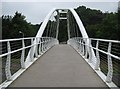
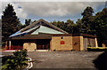
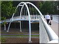
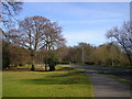
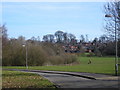
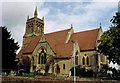
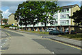
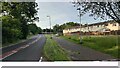
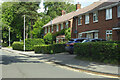
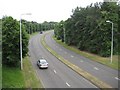
Photos of Easthampstead & Wildridings Ward

Area Information
Easthampstead & Wildridings Ward sits within the Bracknell Forest unitary authority in Berkshire, covering a compact landmass of 2.0 km². Although the wider ward recorded a population of 8,517 in the 2011 census, the specific designation you are viewing accounts for 1,534 residents with a population density of 771 people per square kilometre. This ward combines the suburban character of Wildridings, located approximately one mile south-west of Bracknell town centre, with Easthampstead, a former village now integral to the southern suburbs. You will find this locale situated strategically between the A322 and A3095 roads, offering straightforward road access. The area includes key landmarks such as Bracknell railway station, which connects directly to Reading and London Waterloo via the South Western Railway network. Local interests can visit St Michael and St Mary Magdalene's Church in Easthampstead or use the Wildridings Recreation Ground for leisure. Living in Easthampstead & Wildridings Ward offers a settled environment defined by these specific geographical boundaries and transport links.
- Area Type
- District Borough Unitary Ward
- Area Size
- 2.0 km²
- Population
- 1534
- Population Density
- 771 people/km²
Demographics
Residential life in Easthampstead & Wildridings Ward reflects a mature and established community. The demographic profile indicates a median age of 70, making this one of the oldest wards in the district. This age distribution suggests the area is likely populated by long-term residents and retirees rather than young families seeking to raise children in the immediate vicinity. Home ownership stands at 59%, meaning a substantial portion of the population owns their property outright or with a mortgage. The ward features a mix of accommodation types suitable for single individuals, couples, and empty nesters, though the specific breakdown of household composition is aggregated under the total category. You do not find ethnic diversity or religious data explicitly detailed for this specific ward in the current records. The community feel is shaped by these elderly demographics and the high rate of property ownership, creating a stable residential environment with lower turnover compared to family-centric suburbs.
Household Size
Accommodation Type
Tenure
Ethnic Group
Religion
Household Composition
Age
Household Deprivation
NS-SEC
Explore more demographic insights in this area
Go to Demographics tabPlanning
Planning Constraints
- Flood RiskPremium
- Ramsar Wetland SitesPremium
- Area of Outstanding Natural BeautyPremium
- Protected Nature ReservePremium
- Protected WoodlandPremium
- Crime RiskPremium