Area Overview for Arlington
Photos of Arlington

Area Information
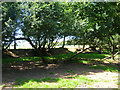
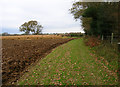
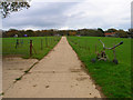
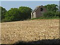
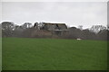
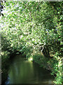
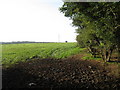
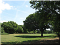
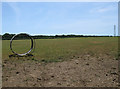
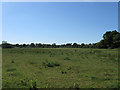
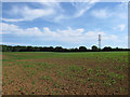
Arlington is a civil parish situated in the Wealden district of East Sussex. It sits on the left bank of the River Cuckmere at coordinates approximately 50.84°N 0.19°E. The area encompasses several settlements including Arlington, Upper Dicker, Milton Street, Wick Street, and Caneheath. Farmland stretches across most of the parish, which spans 18.9 km². A reservoir created in 1971 provides a focal point for local leisure activities such as walking, horse riding, and angling. Visitors can explore the historic Michelham Priory at Upper Dicker, a medieval site founded by Augustinians in 1229. The village also features the Arlington Stadium, which hosts stock car, banger, and motorcycle speedway racing since 1955. Residents enjoy access to local pubs including the Yew Tree Inn, Old Oak Inn, and Plough Inn. This rural setting offers a quiet life while maintaining amenities found within the settlements. You will find yourself surrounded by farmland and historic sites when living in Arlington. The combination of natural resources and community facilities defines daily life here.
- Area Type
- Parish
- Area Size
- 18.9 km²
- Population
- Not available
- Population Density
- Not available
Demographics
The community in Arlington reflects a mature population with a median age of 70 years. This profile indicates a significant presence of older residents within the parish. The total population stands at around 1,287 people across the seven settlements. Homeownership levels are exceptionally high, with 81% of households owning their properties. This statistic suggests a stable community where long-term settlement is the norm. You are likely to meet neighbours who have lived in the area for decades. The household composition data indicates a total makeup consistent with the age profile. Religious and ethnic diversity data is not explicitly detailed in the population breakdown. The demographic picture paints a clear image of a traditional village where the majority of homes are occupied by owners rather than tenants. Living in Arlington means joining a community where property retention and age are defining characteristics.
Household Size
Accommodation Type
Tenure
Ethnic Group
Religion
Household Composition
Age
Household Deprivation
NS-SEC
Explore more demographic insights in this area
Go to Demographics tabPlanning
Planning Constraints
- Flood RiskPremium
- Ramsar Wetland SitesPremium
- Area of Outstanding Natural BeautyPremium
- Protected Nature ReservePremium
- Protected WoodlandPremium