Area Overview for East Saltdean & Telscombe Cliffs Ward
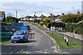
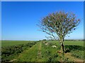
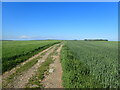
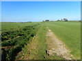
Photos of East Saltdean & Telscombe Cliffs Ward
Area Information
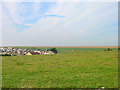
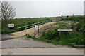
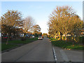
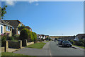
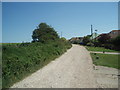
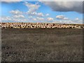
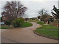
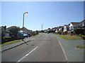
East Saltdean & Telscombe Cliffs Ward occupies a distinctive coastal position within the Lewes District of East Sussex, covering exactly 5.0 km². This mixed ward combines the inland village of Telscombe with the coastal settlements of East Saltdean and Telscombe Cliffs itself. You are standing on the English Channel coast east of Brighton, where the parish encompasses 473 hectares. The area relies on Telscombe Tye downland to separate the inland community from the cliff-top residential zones. Because the ward forms part of Telscombe civil parish, you benefit from ancient boundaries that stretch from the village centre all the way to the cliff edge. St Laurence, the local parish church, anchors the community with origins dating back to the 10th century. While the village gained a civic centre in 2000, it retains the historic character of a settlement that became a town with a mayor in 1974. Living here means you reside within 1.62% of the total Lewes District, yet you possess a complete local infrastructure including a primary school and former judges' lodgings. As you walk towards the coast, you cross the site of the Brighton to Newhaven Cliffs Site of Special Scientific Interest. The Prime Meridian also marks the northeast corner of this parish. Your daily life is shaped by this blend of rural downland and coastal convenience without the congestion found in larger urban centres.
- Area Type
- District Borough Unitary Ward
- Area Size
- 5.0 km²
- Population
- Not available
- Population Density
- Not available
Demographics
The local population in East Saltdean & Telscombe Cliffs Ward reflects a settled and stable community. Although recent census overviews cite a mean age of 43, specific valuation data within this report indicates a median age of exactly 70 years. Households also show a strong preference for ownership, with 78% of residents owning their homes outright or with a mortgage. Of the total households in the ward, this high ownership figure suggests very few rentals dominate the market. The accommodation type data provided applies to the total household composition, and the predominant ethnic group and religion categories are listed as total figures in the dataset. You do not find fragmented demographic bullets here; instead, you engage with a neighbourhood where the vast majority have deep roots in the parish. The community is female-led in terms of population split, with 51.5% of residents identified as female and 48.5% as male. While the provided data does not break down deprivation indices by specific wards within the borough, the overall housing stock supports a standard of living consistent with coastal towns in East Sussex. If you are looking for a community with a clear sense of place, you will find that the demographic profile supports a mature, resident-focused environment rather than a transient population.
Household Size
Accommodation Type
Tenure
Ethnic Group
Religion
Household Composition
Age
Household Deprivation
NS-SEC
Explore more demographic insights in this area
Go to Demographics tabPlanning
Planning Constraints
- Flood RiskPremium
- Ramsar Wetland SitesPremium
- Area of Outstanding Natural BeautyPremium
- Protected Nature ReservePremium
- Protected WoodlandPremium
- Crime RiskPremium