Area Overview for East Lavington
Photos of East Lavington


Area Information
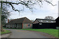
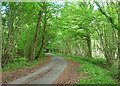
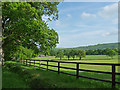
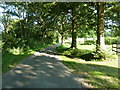
East Lavington is a civil parish situated in England, covering a total area of 8.0 km². This small but distinct location defines the daily lives of its residents within a clearly bounded community. The environment here prioritises stability and a sense of place over rapid development or high-density living. Those choosing to move to East Lavington do so seeking a neighbourhood character grounded in history rather than modern sprawl. Every square kilometre contributes to a setting where the pace of life remains measured. The specific geography shapes how you interact with your surroundings, ensuring that daily commutes and local walks remain manageable within this compact footprint. You will find a community where the boundaries of the parish provide context for everything from local council meetings to neighbourhood events. The scale of the area ensures that you can understand the place without it becoming anonymous. This distinction matters when you evaluate where to build your future home. Living in East Lavington means accepting a defined territory where community identity holds significant weight. The parish structure serves as the primary unit for local governance and social organisation. You engage directly with a management model that keeps decision-making relatively close to residents. This setup works well for those who value clear jurisdictional lines and established local processes. The area does not attempt to compete with larger towns for attention, allowing it to maintain a focused identity. Your time here allows for deep knowledge of available homes near East Lavington because the market remains relatively contained.
- Area Type
- Parish
- Area Size
- 8.0 km²
- Population
- Not available
- Population Density
- Not available
Demographics
The community in East Lavington displays an exceptionally older age profile compared to the national average. The median age stands at 70 years, placing the demographic centre firmly within the senior population brackets. This statistic indicates that you are moving into an area where retirees and older adults form the core of the social fabric. Family life as typically experienced by young parents is not the predominant mode here, though individual circumstances always vary. The household composition data confirms this shift towards older demographics without specifying the exact breakdown of single-person or multi-generational homes. You should anticipate a social environment centred around retirement activities and leisure pursuits common to this age group. Home ownership by residents reaches 73% of the total stock, creating a stable financial landscape. The majority of homes in East Lavington belong to their occupants rather than landlords, which often correlates with longer-term community investment. This high ownership rate suggests a market where people stay in their properties for extended periods. It also implies a different dynamic for potential buyers compared to rental-heavy zones. You will find that the current residents have skin in the game and tend to maintain their properties with care. The average age of 70 reinforced by the 73% ownership figure points to a quiet, established neighbourhood. When you look for homes in East Lavington, your neighbours are likely to be people who have put down roots decades ago. This demographic reality dictates the type of amenities you will see and the social interactions you navigate.
Household Size
Accommodation Type
Tenure
Ethnic Group
Religion
Household Composition
Age
Household Deprivation
NS-SEC
Explore more demographic insights in this area
Go to Demographics tabPlanning
Planning Constraints
- Flood RiskPremium
- Ramsar Wetland SitesPremium
- Area of Outstanding Natural BeautyPremium
- Protected Nature ReservePremium
- Protected WoodlandPremium