Area Overview for East Harting
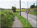
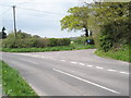
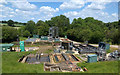
Photos of East Harting


Area Information
East Harting is a compact built-up area in England, covering 27.1 hectares. It is a small, defined community with a median age of 70, suggesting a population skewed towards older residents. The area’s proximity to Petersfield and Liss railway stations offers easy access to regional transport networks. With 71% of homes owner-occupied, the community is largely stable, though the broadband score of 48 indicates limited fixed-line internet quality. Despite this, mobile coverage scores at 81 suggest reliable connectivity for most daily tasks. Living here means navigating a mix of retail options, including The Southern Co-operative Co and Asda Ramshill, within practical reach. The area’s character is defined by its size and the presence of nearby amenities, making it suitable for those prioritising convenience over expansive space. While not a bustling urban hub, East Harting provides a quiet, functional environment for residents seeking proximity to essential services without the noise of larger cities.
- Area Type
- Built Up Area 250
- Area Size
- 27.1 hectares
- Population
- Not available
- Population Density
- Not available
East Harting’s residents have access to a range of nearby amenities, including five retail outlets such as The Southern Co-operative Co, M&S Petersfield SF, and Asda Ramshill. These shops provide essentials like groceries, clothing, and general goods, reducing the need for long trips to larger centres. The two railway stations—Petersfield and Liss—offer direct links to regional transport networks, enhancing access to cultural, professional, and leisure opportunities beyond the immediate area. While there is no data on parks or recreational facilities, the presence of retail and transport options suggests a lifestyle focused on practicality. The compact nature of the area means amenities are closely clustered, making daily errands efficient. However, the absence of specific details on leisure or green spaces means the full character of the area’s lifestyle remains partially undefined.
Amenities
Schools
| Rank | School | Type | Entry gender | Ages |
|---|
Explore more schools in this area
Go to Schools tabDemographics
East Harting has a median age of 70, with the most common age range encompassing the total population. This suggests a community where older residents form a significant proportion. Home ownership is high at 71%, indicating a stable housing market with fewer rental properties. The data does not specify household composition or accommodation types, but the overall profile points to a mature demographic. The lack of detailed breakdowns on ethnicity or religion means no conclusions can be drawn about diversity. For quality of life, the age profile may influence local services, such as healthcare and leisure options tailored to older adults. The absence of specific data on deprivation means the area’s economic challenges cannot be assessed, but the high home ownership rate implies financial stability for many residents.
Household Size
Accommodation Type
Tenure
Ethnic Group
Religion
Household Composition
Age
Household Deprivation
NS-SEC
Explore more demographic insights in this area
Go to Demographics tabPlanning
Planning Constraints
- Crime RiskPremium