Area Overview for East Hagbourne
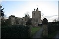
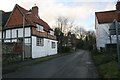
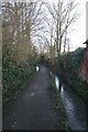
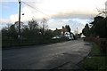
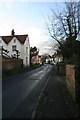
Photos of East Hagbourne


Area Information
East Hagbourne is a compact built-up area in England, covering 50.4 hectares. It is home to a population with a median age of 70, suggesting a community that is predominantly older. The area is characterised by a high level of home ownership, with 82% of residents living in properties they own. Daily life here is shaped by proximity to essential services, including multiple retail outlets and railway stations. The presence of Hagbourne Church of England Primary School, listed twice in the data, indicates a focus on education for younger families. While the area is small, it offers a mix of practical amenities and a relatively safe environment, with a crime risk score of 86, reflecting below-average crime rates. Living in East Hagbourne means access to nearby towns like Wallingford and Didcot, which provide additional facilities and transport links. The combination of modest size, established community, and accessible infrastructure makes it a viable option for those seeking a quieter, well-connected residential area.
- Area Type
- Built Up Area 250
- Area Size
- 50.4 hectares
- Population
- Not available
- Population Density
- Not available
The lifestyle in East Hagbourne is shaped by its proximity to practical amenities, including retail stores like Tesco Didcot, Iceland Didcot, and Co-op Didcot, which offer everyday shopping needs. The area’s rail network, with stations at Didcot Parkway, Appleford, and Cholsey, provides easy access to nearby towns and transport hubs. A metro connection to Wallingford adds further regional reach. While the data does not mention parks or leisure facilities, the availability of multiple retail and transport options suggests a community focused on convenience and accessibility. The presence of a primary school and nearby towns implies a lifestyle that balances local living with opportunities for broader engagement. The character of the area is defined by its practicality, with amenities designed to meet daily needs without requiring long commutes.
Amenities
Schools
The nearest schools to East Hagbourne include Hagbourne Church of England Primary School, listed twice in the data, which serves the local primary education needs. Both entries confirm the presence of a single primary school in the area, though no secondary schools are mentioned. The duplication of the school’s name in the data may reflect a formatting error, but the key takeaway is that primary education is available locally. Families with young children may benefit from the proximity of this school, though the absence of secondary schools could necessitate commuting to nearby towns like Didcot or Wallingford. The school type suggests a faith-based institution, which may align with the community’s religious or cultural preferences.
| Rank | A + A* % | School | Type | Entry gender | Ages |
|---|---|---|---|---|---|
| 1 | N/A | Hagbourne Church of England Primary School | primary | N/A | N/A |
| 2 | N/A | Hagbourne Church of England Primary School | primary | N/A | N/A |
Explore more schools in this area
Go to Schools tabDemographics
The population of East Hagbourne has a median age of 70, with the most common age range encompassing all age groups. Home ownership is high, at 82%, indicating a community where most residents live in their own homes. The data does not specify household composition or diversity, but the high home ownership rate suggests a stable, long-term resident base. The accommodation types are not detailed, but the overall demographic profile points to a mature population. This age demographic may influence local services and amenities, with a focus on healthcare and community support. The area’s characteristics align with a settlement where residents are likely to have lived for many years, contributing to a sense of continuity and familiarity.
Household Size
Accommodation Type
Tenure
Ethnic Group
Religion
Household Composition
Age
Household Deprivation
NS-SEC
Explore more demographic insights in this area
Go to Demographics tabPlanning
Planning Constraints
- Crime RiskLocked