Area Overview for East Grinstead Town Ward
Photos of East Grinstead Town Ward

Area Information
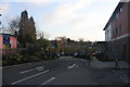
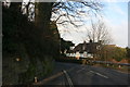
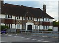
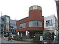
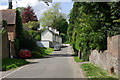
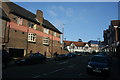
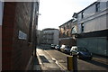
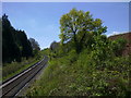
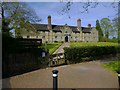
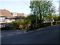
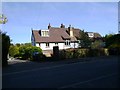
East Grinstead Town Ward occupies a distinctive position as a parish ward within the larger town of East Grinstead. It spans a compact area of 1.6 square kilometres, situated along the Greenwich Meridian. The location places the ward immediately at the junction of the A22 and A264 roads, positioning it approximately 27 miles south of London and 10 miles from Gatwick airport. You live in a settlement that sits precisely on the borders of East Sussex, Surrey, and Kent. Local history reveals the name derives from Old English for a green place, a characteristic reflected in the surrounding parkland where the historic East Court mansion stands. This mansion, built in 1769, now houses the Town Council and overlooks the ward from its elevated position. Living in East Grinstead Town Ward means daily access to major linear cycle paths like Forest Way and Worth Way, which link directly to Ashdown Forest. While you are surrounded by historic architecture and natural beauty, you must navigate significant road congestion where the main arteries overlap. The ward represents a specific microcosm of the wider district, offering a blend of historical significance and modern connectivity. You will find that the area is deep within light of the Weald, yet remains a key transport node for those commuting toward London or the coast.
- Area Type
- District Borough Unitary Ward
- Area Size
- 1.6 km²
- Population
- Not available
- Population Density
- Not available
Demographics
The community profile within East Grinstead Town Ward is defined by an exceptionally aged population. The median age for residents reaches 70 years, indicating a demographic heavily weighted toward older adults. This age structure suggests a neighbourhood where daily life revolves around retirement communities and established households. Ownership of property stands at 51 per cent, meaning slightly more than half of the residents own their homes outright or with a mortgage. The remaining households are tenured through rents or other living arrangements. You will encounter a wide variety of household compositions, as the available data covers total categories without specifying single-person or multi-generational breakdowns. Homeownership levels paint a picture of financial stability for many locals. The ward does not report specific predominance in ethnic groups or religious affiliations, reflecting a diverse mix typical of established towns. Living in East Grinstead Town Ward offers a quiet existence suited to those who have settled down. The elderly population suggests limited nightlife or youth-centric services, though the ward benefits from the broader town's amenities. You are joining a community where life pace likely dictates by availability of medical services, local shops, and community centres rather than vibrant festivals. The 51 per cent homeownership rate ensures a stable ground rent market for those selling or buying within this specific age bracket.
Household Size
Accommodation Type
Tenure
Ethnic Group
Religion
Household Composition
Age
Household Deprivation
NS-SEC
Explore more demographic insights in this area
Go to Demographics tabPlanning
Planning Constraints
- Flood RiskPremium
- Ramsar Wetland SitesPremium
- Area of Outstanding Natural BeautyPremium
- Protected Nature ReservePremium
- Protected WoodlandPremium
- Crime RiskPremium