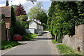
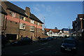
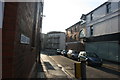
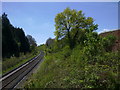
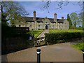
Area Overview for East Grinstead
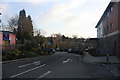
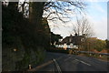
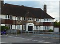
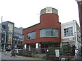
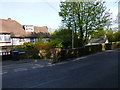
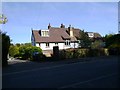
Photos of East Grinstead

Area Information
East Grinstead occupies 7.7 km² in West Sussex and currently serves a population of 4071 people. This built-up area maintains a population density of 526 people per square kilometre, indicating a compact settlement where residents live relatively close to one another. The location functions as a distinct town with established infrastructure and a clear sense of place. Living in East Grinstead means residing in an environment where daily routines rely on local facilities rather than long commutes to the nearest metropolitan centre. The area sits within England and offers a settled atmosphere defined by its moderate size and resident numbers. Prospective buyers looking for a defined community boundary will find East Grinstead provides a clear geographical scope for their future home. The area's character is shaped by these specific physical dimensions and the human element of over four thousand inhabitants sharing the space.
- Area Type
- Built Up Area 250
- Area Size
- 7.7 km²
- Population
- 4071
- Population Density
- 526 people/km²
Residents of East Grinstead enjoy immediate access to a range of retail and transport amenities within practical reach. The local retail scene includes Morrisons Daily, Aldi Dormans, and Sainsburys East, providing convenient options for grocery shopping and daily necessities. Transport links are well-established, with East Grinstead Railway Station, Dormans Railway Station, and Lingfield Railway Station serving different travel needs. Metro connectivity is available via Kingscote and Horsted Keynes stations, offering further expansion for longer journeys. Having five notable retail venues and five railway stations within easy reach places East Grinstead at the centre of networked travel. Shopping trips do not require long journeys since Aldi and Sainsburys are strategically located nearby. The rail network allows commuters to access broader regions without significant delays. These amenities create a lifestyle where local convenience blends with efficient public transport connections for those who choose to travel further afield.
Amenities
Schools
Families considering East Grinstead have access to a selection of primary schools within practical reach of the town. Halsford Park Primary School serves as a local option for younger children in the East Grinstead area. Estcots Primary School, located nearby, holds an Ofsted rating of good, providing a verified standard of education for residents. Blackwell Primary School also caters to the local community, offering another choice for parents. The Meads Primary School completes the list of five primary institutions, and it too carries a good Ofsted rating, confirming a solid network of accredited education providers. Baldwins Hill Primary School, East Grinstead, rounds out the available options for children in the borough. This concentration of primary schools means families do not need to look far for educational facilities. The presence of two schools with good ratings suggests that parents can find high-quality options without travelling beyond the immediate neighbourhood.
| Rank | School | Type | Entry gender | Ages |
|---|
Explore more schools in this area
Go to Schools tabDemographics
The community in East Grinstead is defined by a median age of 70 years, signalling a demographic profile heavily weighted towards older residents. The most common age range data categorises the total population, reflecting a settlement where the elderly form a significant portion of residents. Home ownership stands at 75%, demonstrating that three out of four households in East Grinstead own their property outright or with a mortgage. This high rate suggests the area attracts buyers seeking stability and long-term residence rather than short-term rentals. While specific data on household composition and predominant ethnic groups are not broken down further, the 75% ownership figure provides a clear picture of the local economy. Accommodation type statistics also cover the total stock, indicating a mix of housing solutions suitable for this demographic. A high level of home ownership typically correlates with a stable neighbourhood where families and retirees have established deep roots in East Grinstead.
Household Size
Accommodation Type
Tenure
Ethnic Group
Religion
Household Composition
Age
Household Deprivation
NS-SEC
Explore more demographic insights in this area
Go to Demographics tabPlanning
Planning Constraints
- Crime RiskPremium