Area Overview for East Folkestone Ward
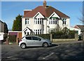
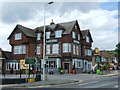
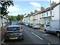
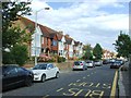
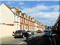
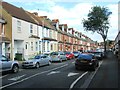
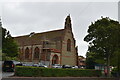
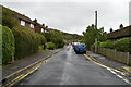
Photos of East Folkestone Ward
Area Information
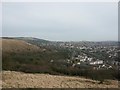
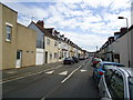
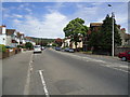
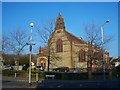
East Folkestone Ward sits on the south coast of Kent within the Folkestone and Hythe District, covering an area of 2.7 km². With a population of 1,477 residents, this ward forms part of the Folkestone and Hythe UK Parliament constituency. The community is compact enough to foster local familiarity, yet connected to the wider town through its official boundaries defined by the Folkestone and Hythe District Council. Living in East Folkestone Ward means navigating a space defined by its coastal location and administrative role within the broader borough. The ward's coordinates place it close to the town centre, offering residents direct access to local services while maintaining a distinct neighbourhood identity. For homebuyers, understanding the ward's status as a specific district council ward is crucial, as it dictates how local elections and planning decisions impact daily life. The area combines residential stability with proximity to regional infrastructure, creating a practical living environment for those settled in the South East of England.
- Area Type
- District Borough Unitary Ward
- Area Size
- 2.7 km²
- Population
- 1477
- Population Density
- 539 people/km²
Demographics
The demographic profile of East Folkestone Ward reveals a mature community with a median age of 70 years. This indicates a population heavily weighted towards older adults, shaping the local demand for services and housing. Roughly 54 per cent of households are owner-occupied, suggesting a stable base of long-term residents who have established roots in the ward. The household composition and accommodation types reflect this established nature, catering primarily to the needs of an older demographic. While specific data regarding predominant ethnic groups and religious affiliation is not granular for this ward level, the age structure clearly defines the social fabric. The high life expectancy typical of coastal Kent areas likely contributes to this age distribution. For anyone considering homes in East Folkestone Ward, the buying public must anticipate a community driven by retirees and mature families rather than young professionals or students. This demographic reality influences local amenities, from healthcare access to community centres specifically designed for senior citizens.
Household Size
Accommodation Type
Tenure
Ethnic Group
Religion
Household Composition
Age
Household Deprivation
NS-SEC
Explore more demographic insights in this area
Go to Demographics tabPlanning
Planning Constraints
- Flood RiskPremium
- Ramsar Wetland SitesPremium
- Area of Outstanding Natural BeautyPremium
- Protected Nature ReservePremium
- Protected WoodlandPremium
- Crime RiskPremium