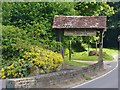
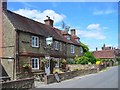
Area Overview for Easebourne
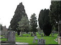
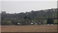
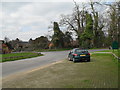
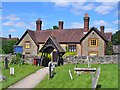
Photos of Easebourne


Area Information
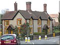
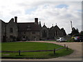
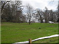
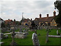
Easebourne is a compact built-up area spanning 69.8 hectares in England, offering a quiet, low-density living environment. With a median age of 70, the community is predominantly older, reflecting a demographic profile shaped by long-term residency. This area is not defined by towering developments or high-rise living; instead, it features a mix of traditional housing stock that suits those seeking a slower pace of life. Daily life in Easebourne is characterised by proximity to essential services, including five retail outlets such as M&S Midhurst BP and Tesco Midhurst, alongside a railway station at Liphook. The presence of three schools—Easebourne CofE Primary School, Midhurst Intermediate School, and Conifers School—ensures families have access to both state and independent education options. While the area’s broadband connectivity is rated poor, mobile coverage is strong, supporting everyday communication. Easebourne’s charm lies in its balance of practicality and tranquillity, making it a viable choice for those prioritising safety, community stability, and ease of access to nearby amenities.
- Area Type
- Built Up Area 250
- Area Size
- 69.8 hectares
- Population
- Not available
- Population Density
- Not available
Residents of Easebourne benefit from a range of nearby amenities within easy reach. Five retail outlets, including M&S Midhurst BP, Tesco Midhurst, and Spar, offer shopping convenience for everyday needs. The Liphook Railway Station provides access to public transport, linking the area to broader networks. While parks and leisure facilities are not explicitly detailed, the presence of schools and retail hubs suggests a community-oriented environment. The mix of shops and transport options supports a practical lifestyle, though the area’s smaller scale means it lacks large-scale leisure venues. For those valuing simplicity and accessibility, Easebourne’s amenities align with a low-maintenance, community-focused way of life.
Amenities
Schools
Easebourne’s educational landscape includes three schools within practical reach. Easebourne CofE Primary School is a state-funded institution with a ‘good’ Ofsted rating, ensuring quality primary education. Midhurst Intermediate School, also a primary school, serves the local community, while Conifers School is an independent institution offering alternative educational pathways. This mix of state and independent schools provides families with choices, whether they prioritise affordability or specialised curricula. The presence of both school types reflects Easebourne’s role as a hub for families seeking varied educational options. However, no data on secondary schools or pupil performance is available, so further research may be needed for comprehensive planning.
| Rank | School | Type | Entry gender | Ages |
|---|
Explore more schools in this area
Go to Schools tabDemographics
Easebourne’s population is defined by its median age of 70, indicating a community where older residents form a significant proportion. The home ownership rate of 64% suggests a stable housing market with many properties held by long-term residents. However, the data does not specify household composition or accommodation types, so details on family structures or housing diversity are absent. The predominant ethnic group and religious composition are not provided, meaning broader demographic diversity cannot be assessed. The low crime risk score of 80, categorised as ‘pass,’ implies a generally safe environment, though no specific data on deprivation or socioeconomic challenges is available. For those considering Easebourne, the demographic profile suggests a mature, settled population with a focus on stability over rapid change.
Household Size
Accommodation Type
Tenure
Ethnic Group
Religion
Household Composition
Age
Household Deprivation
NS-SEC
Explore more demographic insights in this area
Go to Demographics tabPlanning
Planning Constraints
- Crime RiskPremium