Area Overview for Durrington Ward
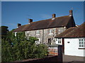
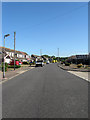
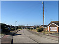
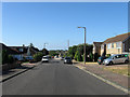
Photos of Durrington Ward
Area Information
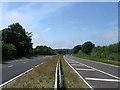
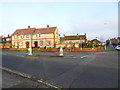
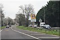
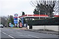
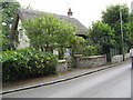
Durrington Ward is a compact electoral ward situated within the Borough of Worthing in West Sussex. This district occupies just 1.1 km², yet it serves as a significant part of the broader Worthing West parliamentary constituency. The area encompasses specific postcodes including BN13 2RW, BN13 2SN, and BN13 2QB, forming a tight-knit neighbourhood around coordinates 50.833604, -0.407344. You will find key thoroughfares such as Durrington Lane and Greenland Road weaving through the ward, linking residential streets to local services. The presence of Durrington Health Centre indicates a focus on community care, while a ward sharing the same name exists locally within the west wing of Worthing Hospital. Living in Durrington Ward means residing in a space that is small by area but substantial in administrative function. The locality sits comfortably within the South East of England, offering proximity to coastal amenities found in Worthing. For those considering homes in this sector, the small footprint suggests a dense, perhaps village-like feel despite being part of a larger borough. Daily life here involves navigating familiar streets where the boundaries between residential living and public services remain closely intertwined. The area benefits from established infrastructure, ensuring that essential services are readily accessible without requiring long travels outside the immediate postcode district.
- Area Type
- District Borough Unitary Ward
- Area Size
- 1.1 km²
- Population
- Not available
- Population Density
- Not available
Demographics
The community within Durrington Ward displays a very distinct age profile with a median age of 70. This statistic confirms that the population is overwhelmingly composed of senior residents, a fact that defines the social fabric of the ward. Household composition and accommodation type data are recorded for the area, yet the specific breakdowns for these categories remain generalised in the available records. You will encounter a community where generations have settled permanently, reflected in a high level of property stability. Home ownership stands at 72%, a figure that significantly influences the local culture and decision-making processes. This high ownership rate suggests that most families living in Durrington Ward have put down roots rather than renting transiently. The diversity of the population is noted in the total count but lacks specific detailed breakdowns regarding ethnic groups or religious affiliations. Despite the lack of granular data on these categories, the stable home ownership level of 72% indicates a settled society. Residents here likely engage with neighbours who share similar life stages and long-term commitments to the area. When considering the community feel, you should expect an environment dominated by the needs and rhythms of older generations, rather than a mix of young families or transient professionals typical of younger wards.
Household Size
Accommodation Type
Tenure
Ethnic Group
Religion
Household Composition
Age
Household Deprivation
NS-SEC
Explore more demographic insights in this area
Go to Demographics tabPlanning
Planning Constraints
- Flood RiskPremium
- Ramsar Wetland SitesPremium
- Area of Outstanding Natural BeautyPremium
- Protected Nature ReservePremium
- Protected WoodlandPremium
- Crime RiskPremium