Area Overview for Durley
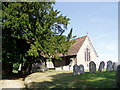
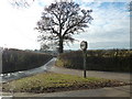
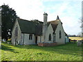
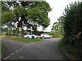
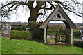
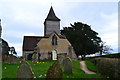
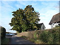
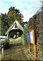
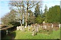
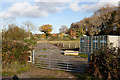
Photos of Durley
Area Information
Living in Durley offers a compact, well-defined environment within a 25.4-hectare built-up area. Situated in England, it is a small town or city with a distinct character shaped by its residents and local amenities. The area’s population is predominantly older, with a median age of 70, reflecting a community that values stability and established living. Home ownership is high, with 79% of properties owner-occupied, suggesting a long-term presence of residents. Durley’s proximity to key services, including five railway stations like Hedge End and Eastleigh, and nearby retail outlets such as Tesco Fair, ensures practical connectivity. The area’s single outstanding-rated primary school, Durley Church of England Controlled Primary School, highlights its appeal for families. While the population size is not specified, the area’s compact nature means daily life is centred around local hubs, with a balance between accessibility and a sense of community. For buyers, Durley’s blend of practical amenities and a mature demographic makes it a viable option for those seeking a settled, low-maintenance lifestyle.
- Area Type
- Built Up Area 250
- Area Size
- 25.4 hectares
- Population
- Not available
- Population Density
- Not available
Durley’s residents have access to a range of amenities within practical reach, including five railway stations, such as Botley and Eastleigh, and five retail outlets like Tesco Fair. The presence of two airports, both named Southampton Airport, adds to the area’s connectivity, though specific details on their proximity are not provided. The compact size of the area means local shops and transport options are easily accessible, supporting a convenient lifestyle. While the data does not mention parks or leisure facilities, the railway stations and retail options suggest a focus on practicality over expansive recreational spaces. For those prioritising ease of access to services and transport, Durley offers a straightforward, functional environment.
Amenities
Schools
The nearest school to Durley is the Durley Church of England Controlled Primary School, an outstanding-rated primary institution. This single school is the only one listed in the data, indicating a limited range of educational options for families. The absence of secondary schools or other educational facilities means parents must consider proximity to other districts for secondary education. The outstanding rating suggests high-quality teaching and resources at the primary level, which is a significant advantage for families prioritising academic standards. However, the lack of additional schools may require careful planning for older children. For those valuing a strong primary education, Durley’s school is a clear strength, but the broader educational landscape remains undefined by the data.
| Rank | School | Type | Entry gender | Ages |
|---|
Explore more schools in this area
Go to Schools tabDemographics
Durley’s population is characterised by a median age of 70, with the most common age range encompassing the total population. This suggests a community largely composed of older adults, which influences the area’s social dynamics and service needs. Home ownership is high at 79%, indicating a strong presence of long-term residents. The data does not specify household composition or accommodation types, but the overall figures imply a stable, possibly family-oriented population. The lack of detailed information on diversity or deprivation means the area’s broader social fabric remains less defined. However, the high home ownership rate and the presence of an outstanding primary school suggest a focus on quality of life for existing residents. The absence of specific data on ethnic groups or religious demographics means these aspects cannot be addressed, but the available figures highlight a community prioritising permanence and local infrastructure.