Area Overview for Downswood
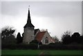
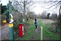
Photos of Downswood


Area Information
Living in Downswood means settling into a small civil parish that spans just 35.9 hectares. This compact footprint creates an intimate community where neighbours are often known by name rather than just by address. The area is defined by its manageable size, which fosters a quiet, residential pace of life distinct from larger suburban patches. You are stepping away from the noise of busy town centres into a space designed for peace and privacy. The small scale ensures that daily commutes within the parish feel short and predictable, making it an ideal location for those who value stillness over stimulation. The demographics reveal a settlement where tradition meets stability. With a median age of 70, the population skews significantly towards retired residents who have chosen this spot for its tranquility. This age profile shapes the local rhythm; the streets are likely lined with established gardens and从容 homes rather than manicured estates or high-rise blocks. You would find a community built on long-term residency rather than transient living. The low pressure of a tiny population size means there is less congestion and a stronger sense of shared neighbourhood ownership. When you consider homes in Downswood, you are buying into a legacy environment where the built history matches the demographic reality. It is a place for slower living, where the surroundings are measured in hectares rather than housing units or extreme density. This setting offers a rare chance to own a home in a virtually private pocket of countryside where the primary constraint is distance from major city centres rather than space or budget limits. The social fabric of Downswood is defined by a very specific age profile. The median age here is 70 years old, which positions this parish as a community dominated by the older generation. When you look at living in Downswood, you will encounter an area where the average person in the street is significantly older than the national average. This demographic concentration is not an anomaly; it is the defining characteristic of daily life for many residents. It suggests a population that has settled down after a lifetime of work or has moved here specifically for retirement. Home ownership permeates this older demographic, with 74% of households owning their properties outright or with a mortgage. This high rate of ownership indicates deep local roots and stability within the community. You are unlikely to find a large transient rental population moving in and out frequently. Instead, the residents are long-term homeowners who have invested in their specific plots of land across these 35.9 hectares. The household composition reflects a desire for space and independence, which aligns perfectly with the large share of owner-occupied dwellings. Accommodation types in this parish are predominantly suited to those who require less movement and more quiet, reinforcing the retirement appeal. The community is diverse in its history rather than its ethnicity, with a population that has formed over decades rather than recently. There are no signs of rapid population shifts or the churn typical of young family hubs. The lack of specific data regarding deprivation metrics in the provided records means that one cannot assess economic inequalities here with the usual statistical tools. However, the combination of a predominantly older population and high home ownership rates suggests a relatively stable economic environment. Residents are likely focused on leisure and maintenance rather than the early-stage career building that characterises younger areas. This naturally creates a quieter, lower-stress atmosphere. You will find that the neighbours you meet are people with financial security built over time, allowing the community to focus on local upkeep rather than economic pressure. The 74% ownership figure is the strongest indicator of this stability, showing that most families have the means to stay put. The property market in Downswood is clearly an owner-occupied sphere rather than a bustling rental landscape. With 74% of households classified as owner-occupied, the majority of residents have purchased homes in this parish to remain there for the long term. When looking at homes in Downswood, you will find a stock that reflects the needs of retirees and mature families who value permanence over flexibility. This high ownership rate implies that the available properties are primarily established residential buildings rather than modern developments or purpose-built rental flats. The accommodation type data supports a picture of traditional, standalone housing spread across the 35.9 hectares. If you are considering buying, the market here caters to those seeking a fixed address with minimal uncertainty. The prevalence of owner-occupied homes suggests that tenancies turn over slowly, resulting in a stable neighbourhood where you are buying from people who intend to move only if they need to. This stability is attractive to buyers who wish to settle down without the fear of disruptive tenant turnover. The housing stock is likely composed of bungalows or single-storey adaptations given the median age of 70, though the exact architectural breakdown is not detailed in the available records. You can expect a market that is slower-paced, with sellers who are often motivated by lifestyle desires rather than immediate financial necessity. This market dynamic means that competition can be lower than in dynamic hubs where investors or young professionals chase limited inventory. Instead, properties sell based on their suitability for retirement or quiet living. The high ownership percentage also suggests that equity release might be a factor for some sellers, potentially offering more deferential negotiation compared to cash-driven investment buyers. For you, the buyer, this translates into a buying experience focused on finding the right home for a lifetime rather than a speculative asset. Digital connectivity in Downswood is robust and reliable, ensuring that living here poses no barriers to remote working or online life. The fixed broadband score reaches the maximum отметка of 100 out of 100, indicating that you will have access to the highest quality internet speeds available in the region. This excellent coverage means you can run multiple video calls, stream content, and manage cloud-based tasks without interruption, regardless of your specific plot within the parish. For anyone considering a career in remote work or simply relying heavily on digital services, this broadband infrastructure removes a common anxiety associated with rural or semi-rural locations. Mobile network quality also scores highly with an 84 out of 100 rating. This level of performance is classified as good to excellent, providing you with consistent coverage for your smartphone while walking the neighbourhood or driving through the area. Residents can navigate the 35.9 hectares with confidence, knowing that their connection will remain strong enough for emergency calls, navigation updates, and staying in touch with family. The combination of top-tier fixed broadband and strong mobile signals creates a connected environment that does not require you to compromise on convenience for the sake of scenery. When you think about connectivity for daily use, you will find that the digital infrastructure keeps pace with modern demands. You do not need to worry about Wi-Fi dead zones or poor signal strength affecting your ability to work from home. The digital landscape here supports a fully functional remote lifestyle, allowing you to manage finance, shop online, and coordinate appointments with the same ease as those living in city centres. This level of connectivity is particularly valuable for an area where physical transport options might be limited, as the internet becomes your primary link to the wider world. Safety in Downswood is a primary strength of living in this parish. The crime risk assessment rates as PASS with a score of 76 out of 100, indicating below-average crime rates relative to other areas. This low risk score confirms that the neighbourhood is a safe environment for residents, particularly important given the median age of 70. You can enjoy a quiet evening out or walk your garden without significant concern for violent crime or theft. The data supports a clear picture of a calm community where the primary safety focus is on general well-being rather than security threats. Environmental considerations are equally favourable for anyone becoming a resident. There is no record of flood risk posing a threat to homes in Downswood, as the flood risk assessment passes with a score of 7.97 out of 100. This low score signifies a negligible chance of flooding, allowing you to ignore concerns about water damage or insurance premiums related to flood vulnerability. Furthermore, the area is free from planning constraints associated with protected natural sites. There are no Ramsar wetland sites, Areas of Outstanding Natural Beauty, protected nature reserves, or protected woodland within the boundaries of the parish. These zero scores reflect the absence of these specific regulated zones rather than the lack of beauty or greenery. The absence of these planning constraints simplifies the housing market and gives you confidence in the long-term stability of your purchase. You are not purchasing a property held back by strict conservation covenants or recent special designations. This clarity allows you to envision your home as a standalone asset within a peaceful setting. The combination of low crime risk, no flood threat, and no protected land constraints paints a picture of a straightforward, safe, and uncomplicated living environment. Is Downswood considered a safe area for retirees to live?Downswood is a safe area with a crime risk score of 76 out of 100, placing it in the range of below-average crime rates. With a median age of 70 and a high level of home ownership at 74%, the community is stable and secure. Residents report a low crime risk, making it an ideal, low-concern environment for retirement living. The area passes safety assessments, ensuring you can relax while living in Downswood. What is the age profile of the people living in Downswood?The demographic profile of Downswood is distinctly older than most parts of the country. The median age is 70 years old, meaning the community is dominated by retirees. This older age group correlates with a 74% home ownership rate, suggesting a population that has settled long-term. When you consider schools near Downswood, note that the area is primarily suited to adult learners or grandparents rather than young families with school-age children. The community feel is one of maturity and quiet stability, fitting for those seeking a retirement destination. Will I have reliable internet for working from home in Downswood?Digital connectivity in Downswood is excellent, with a fixed broadband score of 100 out of 100. This means you will have access to the highest quality internet speeds available, supporting seamless video conferencing and large file transfers. Additionally, the mobile coverage score is 84 out of 100, providing good to excellent network reliability across the parish. You do not need to worry about connectivity issues; the infrastructure is designed to support a fully remote lifestyle for anyone living in Downswood, regardless of your specific property. Are there any environmental risks or planning constraints for homes in Downswood?Living in Downswood carries minimal environmental risk. The area has a low flood risk score of 7.97, indicating very little threat from water damage. There are also no Ramsar wetland sites or Areas of Outstanding Natural Beauty within the parish boundaries. The scores for protected nature reserves and protected woodland are both zero, showing no restricted ecological zones. This clear status means you are buying a freehold home without the complications of planning designations, allowing for straightforward ownership. The 35.9 hectares of the parish are free from these specific constraints.
- Area Type
- Parish
- Area Size
- 35.9 hectares
- Population
- Not available
- Population Density
- Not available
Demographics
The social fabric of Downswood is defined by a very specific age profile. The median age here is 70 years old, which positions this parish as a community dominated by the older generation. When you look at living in Downswood, you will encounter an area where the average person in the street is significantly older than the national average. This demographic concentration is not an anomaly; it is the defining characteristic of daily life for many residents. It suggests a population that has settled down after a lifetime of work or has moved here specifically for retirement. Home ownership permeates this older demographic, with 74% of households owning their properties outright or with a mortgage. This high rate of ownership indicates deep local roots and stability within the community. You are unlikely to find a large transient rental population moving in and out frequently. Instead, the residents are long-term homeowners who have invested in their specific plots of land across these 35.9 hectares. The household composition reflects a desire for space and independence, which aligns perfectly with the large share of owner-occupied dwellings. Accommodation types in this parish are predominantly suited to those who require less movement and more quiet, reinforcing the retirement appeal. The community is diverse in its history rather than its ethnicity, with a population that has formed over decades rather than recently. There are no signs of rapid population shifts or the churn typical of young family hubs. The lack of specific data regarding deprivation metrics in the provided records means that one cannot assess economic inequalities here with the usual statistical tools. However, the combination of a predominantly older population and high home ownership rates suggests a relatively stable economic environment. Residents are likely focused on leisure and maintenance rather than the early-stage career building that characterises younger areas. This naturally creates a quieter, lower-stress atmosphere. You will find that the neighbours you meet are people with financial security built over time, allowing the community to focus on local upkeep rather than economic pressure. The 74% ownership figure is the strongest indicator of this stability, showing that most families have the means to stay put. The property market in Downswood is clearly an owner-occupied sphere rather than a bustling rental landscape. With 74% of households classified as owner-occupied, the majority of residents have purchased homes in this parish to remain there for the long term. When looking at homes in Downswood, you will find a stock that reflects the needs of retirees and mature families who value permanence over flexibility. This high ownership rate implies that the available properties are primarily established residential buildings rather than modern developments or purpose-built rental flats. The accommodation type data supports a picture of traditional, standalone housing spread across the 35.9 hectares. If you are considering buying, the market here caters to those seeking a fixed address with minimal uncertainty. The prevalence of owner-occupied homes suggests that tenancies turn over slowly, resulting in a stable neighbourhood where you are buying from people who intend to move only if they need to. This stability is attractive to buyers who wish to settle down without the fear of disruptive tenant turnover. The housing stock is likely composed of bungalows or single-storey adaptations given the median age of 70, though the exact architectural breakdown is not detailed in the available records. You can expect a market that is slower-paced, with sellers who are often motivated by lifestyle desires rather than immediate financial necessity. This market dynamic means that competition can be lower than in dynamic hubs where investors or young professionals chase limited inventory. Instead, properties sell based on their suitability for retirement or quiet living. The high ownership percentage also suggests that equity release might be a factor for some sellers, potentially offering more deferential negotiation compared to cash-driven investment buyers. For you, the buyer, this translates into a buying experience focused on finding the right home for a lifetime rather than a speculative asset. Digital connectivity in Downswood is robust and reliable, ensuring that living here poses no barriers to remote working or online life. The fixed broadband score reaches the maximum отметка of 100 out of 100, indicating that you will have access to the highest quality internet speeds available in the region. This excellent coverage means you can run multiple video calls, stream content, and manage cloud-based tasks without interruption, regardless of your specific plot within the parish. For anyone considering a career in remote work or simply relying heavily on digital services, this broadband infrastructure removes a common anxiety associated with rural or semi-rural locations. Mobile network quality also scores highly with an 84 out of 100 rating. This level of performance is classified as good to excellent, providing you with consistent coverage for your smartphone while walking the neighbourhood or driving through the area. Residents can navigate the 35.9 hectares with confidence, knowing that their connection will remain strong enough for emergency calls, navigation updates, and staying in touch with family. The combination of top-tier fixed broadband and strong mobile signals creates a connected environment that does not require you to compromise on convenience for the sake of scenery. When you think about connectivity for daily use, you will find that the digital infrastructure keeps pace with modern demands. You do not need to worry about Wi-Fi dead zones or poor signal strength affecting your ability to work from home. The digital landscape here supports a fully functional remote lifestyle, allowing you to manage finance, shop online, and coordinate appointments with the same ease as those living in city centres. This level of connectivity is particularly valuable for an area where physical transport options might be limited, as the internet becomes your primary link to the wider world. Safety in Downswood is a primary strength of living in this parish. The crime risk assessment rates as PASS with a score of 76 out of 100, indicating below-average crime rates relative to other areas. This low risk score confirms that the neighbourhood is a safe environment for residents, particularly important given the median age of 70. You can enjoy a quiet evening out or walk your garden without significant concern for violent crime or theft. The data supports a clear picture of a calm community where the primary safety focus is on general well-being rather than security threats. Environmental considerations are equally favourable for anyone becoming a resident. There is no record of flood risk posing a threat to homes in Downswood, as the flood risk assessment passes with a score of 7.97 out of 100. This low score signifies a negligible chance of flooding, allowing you to ignore concerns about water damage or insurance premiums related to flood vulnerability. Furthermore, the area is free from planning constraints associated with protected natural sites. There are no Ramsar wetland sites, Areas of Outstanding Natural Beauty, protected nature reserves, or protected woodland within the boundaries of the parish. These zero scores reflect the absence of these specific regulated zones rather than the lack of beauty or greenery. The absence of these planning constraints simplifies the housing market and gives you confidence in the long-term stability of your purchase. You are not purchasing a property held back by strict conservation covenants or recent special designations. This clarity allows you to envision your home as a standalone asset within a peaceful setting. The combination of low crime risk, no flood threat, and no protected land constraints paints a picture of a straightforward, safe, and uncomplicated living environment. Is Downswood considered a safe area for retirees to live?Downswood is a safe area with a crime risk score of 76 out of 100, placing it in the range of below-average crime rates. With a median age of 70 and a high level of home ownership at 74%, the community is stable and secure. Residents report a low crime risk, making it an ideal, low-concern environment for retirement living. The area passes safety assessments, ensuring you can relax while living in Downswood. What is the age profile of the people living in Downswood?The demographic profile of Downswood is distinctly older than most parts of the country. The median age is 70 years old, meaning the community is dominated by retirees. This older age group correlates with a 74% home ownership rate, suggesting a population that has settled long-term. When you consider schools near Downswood, note that the area is primarily suited to adult learners or grandparents rather than young families with school-age children. The community feel is one of maturity and quiet stability, fitting for those seeking a retirement destination. Will I have reliable internet for working from home in Downswood?Digital connectivity in Downswood is excellent, with a fixed broadband score of 100 out of 100. This means you will have access to the highest quality internet speeds available, supporting seamless video conferencing and large file transfers. Additionally, the mobile coverage score is 84 out of 100, providing good to excellent network reliability across the parish. You do not need to worry about connectivity issues; the infrastructure is designed to support a fully remote lifestyle for anyone living in Downswood, regardless of your specific property. Are there any environmental risks or planning constraints for homes in Downswood?Living in Downswood carries minimal environmental risk. The area has a low flood risk score of 7.97, indicating very little threat from water damage. There are also no Ramsar wetland sites or Areas of Outstanding Natural Beauty within the parish boundaries. The scores for protected nature reserves and protected woodland are both zero, showing no restricted ecological zones. This clear status means you are buying a freehold home without the complications of planning designations, allowing for straightforward ownership. The 35.9 hectares of the parish are free from these specific constraints.
Household Size
Accommodation Type
Tenure
Ethnic Group
Religion
Household Composition
Age
Household Deprivation
NS-SEC
Explore more demographic insights in this area
Go to Demographics tabPlanning
Planning Constraints
- Flood RiskPremium
- Ramsar Wetland SitesPremium
- Area of Outstanding Natural BeautyPremium
- Protected Nature ReservePremium
- Protected WoodlandPremium
- Crime RiskPremium