Area Overview for Dover
Photos of Dover


Area Information
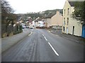
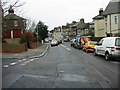
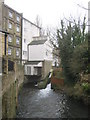
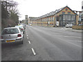
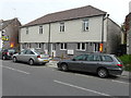
Living in Dover offers a distinct experience shaped by its compact scale and coastal setting. This built-up area spans just 8.2 km², creating a tightly knit environment where daily life is concentrated. With a population of 4,268, the neighbourhood remains intimate despite its proximity to the Kent coastline. The density stands at 517 people per km², reflecting a residential focus rather than urban sprawl. You find yourself in a community where distances are short, making it easy to navigate on foot or by bicycle. The area serves as a home for a significant number of people seeking a quieter pace of life compared to historic Dover town centre. The geography defines the character of the zone, blending residential streets with the proximity to major transport hubs. Families and individuals often choose this locale for its balance of accessibility and relative seclusion. Daily routines involve short commutes to nearby services without the congestion found in larger cities. The small footprint means that local amenities are rarely far away, supporting a self-contained lifestyle. You can appreciate the town's unique position without the scale of a major metropolitan area. This setting provides a clear definition of what living in Dover entails for current and prospective residents.
- Area Type
- District/Borough
- Area Size
- 8.2 km²
- Population
- 4268
- Population Density
- 517 people/km²
Demographics
The community profile in Dover reveals a mature population with a median age of 70. This higher age figure indicates a significant presence of retirees and older adults within the local housing stock. The most common age grouping is recorded as total, suggesting balanced representation across all age brackets in the demographic census. Home ownership stands at 57%, meaning more than half of the households own their properties outright or with a mortgage. This majority of owner-occupied homes contributes to community stability and reduced tenant turnover. The data also breaks down household composition and total accommodation types to show the distribution of living arrangements. While specific ethnic group figures and religious affiliations are noted in the total categories, the dominant characteristics point towards an established residential base. A community with such a high median age often features a steady population with lower migration rates. You will find a neighbourhood where long-term residents have shaped the local culture over many years. The housing snapshot suggests a market geared towards those seeking stability rather than transient living arrangements. Understanding these demographics helps you gauge the neighbours you might meet during your time living in Dover.
Household Size
Accommodation Type
Tenure
Ethnic Group
Religion
Household Composition
Age
Household Deprivation
NS-SEC
Explore more demographic insights in this area
Go to Demographics tabPlanning
Planning Constraints
- Crime RiskLocked