Area Overview for Dockenfield
Photos of Dockenfield


Area Information
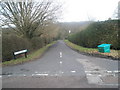
Dockenfield is a compact built-up area in England, covering 41.6 hectares. Its small size means it is likely a focused, tightly knit community rather than a sprawling suburb. The area’s demographics suggest a mature population, with a median age of 70, indicating a community that may be more established, with fewer families and more retirees. This profile shapes the character of daily life, which is likely quiet and steady, with a strong emphasis on local amenities and proximity to transport links. Residents benefit from nearby rail stations, including Bentley, Farnham, and Alton, which provide access to broader regional networks. The area’s limited size means that essential services are within practical reach, though its appeal may depend on whether this compactness feels limiting or comforting. For buyers seeking a low-maintenance, stable environment with easy access to rail and local shops, Dockenfield could be a pragmatic choice. However, the lack of detailed data on diversity or younger demographics means its broader social fabric remains partially opaque.
- Area Type
- Built Up Area 250
- Area Size
- 41.6 hectares
- Population
- Not available
- Population Density
- Not available
Living in Dockenfield offers access to a range of nearby amenities within practical reach. The area is served by five retail outlets, including Spar and The Southern Co-operative Co, providing convenience for daily shopping needs. Three rail stations—Bentley, Farnham, and Alton—offer direct links to regional transport networks, making it easier to commute or travel. While the data does not specify parks or leisure facilities, the presence of multiple retail and transport options suggests a functional, if modest, lifestyle. The local shops and rail connections contribute to a self-contained environment, reducing the need for long commutes. However, the absence of detailed information on dining or recreational venues means the area’s social and cultural offerings remain unclear. For those valuing proximity to essential services and transport, Dockenfield provides a straightforward, practical lifestyle.
Amenities
Schools
| Rank | School | Type | Entry gender | Ages |
|---|
Explore more schools in this area
Go to Schools tabDemographics
The population of Dockenfield has a median age of 70, with the most common age range encompassing all age groups. This suggests a community skewed towards older residents, which may influence local services and amenities. Home ownership is high at 80%, indicating a stable, long-term resident base rather than a transient rental market. The data does not specify household composition or accommodation types, but the overall figures imply a mix of family homes and single-occupancy properties. The predominant ethnic group and religious breakdown are not detailed, but the absence of specific data means the area’s cultural diversity remains undefined. For buyers, this demographic profile may translate into a quieter, less congested environment, though it also raises questions about the availability of schools or childcare facilities, which are not mentioned in the data. The lack of detailed figures on deprivation or income levels means the area’s economic resilience cannot be fully assessed.
Household Size
Accommodation Type
Tenure
Ethnic Group
Religion
Household Composition
Age
Household Deprivation
NS-SEC
Explore more demographic insights in this area
Go to Demographics tabPlanning
Planning Constraints
- Crime RiskPremium