Area Overview for Ditchling
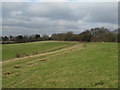
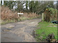
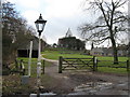
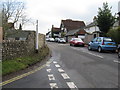
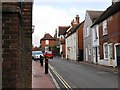
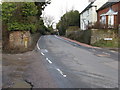
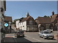
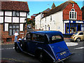
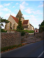
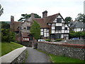
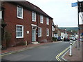
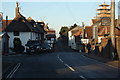
Photos of Ditchling
Area Information
Ditchling, a built-up area in England spanning 81.8 hectares, offers a compact yet well-connected living environment. With a median age of 70, the community reflects a mature demographic, suggesting a settled population with established roots. The area’s high home ownership rate of 83% indicates a strong presence of long-term residents. Daily life is supported by nearby amenities, including five retail outlets such as Morrisons and Sainsburys, and five rail stations—Hassocks, Plumpton, and Burgess Hill—ensuring easy access to regional transport networks. The proximity to schools, including two primary schools named Ditchling St Margaret’s Church of England Primary School, underscores the area’s appeal to families. Digital connectivity is robust, with a broadband score of 92 and mobile coverage of 81, making it suitable for remote work and everyday internet use. Ditchling balances quiet residential character with practical infrastructure, ideal for those seeking a stable, community-focused environment.
- Area Type
- Built Up Area 250
- Area Size
- 81.8 hectares
- Population
- Not available
- Population Density
- Not available
Ditchling’s lifestyle is supported by a range of nearby amenities within practical reach. Retail options include Morrisons, Sainsburys, and Co-op, offering everyday shopping needs. The five rail stations—Hassocks, Plumpton, and Burgess Hill—provide direct access to regional transport networks, enhancing connectivity. While the area lacks detailed data on parks or leisure facilities, the presence of retail and rail services suggests a focus on convenience. The proximity to schools and shops indicates a community-oriented environment, though the absence of specific information on recreational spaces means the area’s character beyond these amenities remains unexplored.
Amenities
Schools
Ditchling is served by two primary schools: Ditchling St Margaret’s Church of England Primary School. Both are primary institutions, though no Ofsted ratings are provided in the data. The presence of two schools within the area suggests a focus on early education, though the absence of secondary schools means families may need to look beyond Ditchling for comprehensive schooling. The duplication of school names may indicate a single institution with multiple references, but the data does not clarify this. For families, the availability of primary education is a key draw, though broader educational needs may require additional planning.
| Rank | School | Type | Entry gender | Ages |
|---|
Explore more schools in this area
Go to Schools tabDemographics
Ditchling’s population has a median age of 70, placing it well above the national average, which suggests a community of older residents. The home ownership rate stands at 83%, reflecting a predominantly owner-occupied area with limited rental activity. While specific data on household composition, accommodation types, or ethnic diversity is not provided, the high home ownership figure indicates a stable, long-term resident base. The area’s age profile may influence local services and amenities, with a focus on accessibility and healthcare. The lack of detailed demographic breakdowns means broader trends, such as social cohesion or cultural diversity, remain unquantified. However, the existing data highlights a mature, settled population with a strong emphasis on property ownership.