Area Overview for Densole
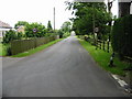
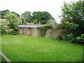
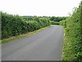
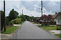
Photos of Densole


Area Information
Densole is a built-up area in England covering 51.3 hectares, characterised by a compact, well-serviced layout. With a median age of 70, the population reflects a mature demographic, suggesting a community rooted in stability and experience. The area is accessible via multiple transport links, including rail stations at Folkestone West, Central, and Sandling, alongside metro stops at Shepherdswell and Hythe. Nearby, the Folkestone Eurotunnel Terminal provides direct connections to mainland Europe, while retail hubs like Tesco Hawkinge, Lidl Hawkinge, and Sainsburys West ensure everyday convenience. Densole’s mix of local amenities and strategic connectivity makes it appealing for those prioritising ease of access to both regional and international destinations. The area’s older population may indicate a preference for established housing stock, though the 71% home ownership rate suggests a strong presence of long-term residents. Daily life here balances practicality with proximity to essential services, offering a quiet yet connected lifestyle.
- Area Type
- Built Up Area 250
- Area Size
- 51.3 hectares
- Population
- Not available
- Population Density
- Not available
Living in Densole offers access to a range of practical amenities within reach. Retail options include major supermarkets such as Tesco Hawkinge, Lidl Hawkinge, and Sainsburys West, ensuring everyday shopping needs are met. The area’s transport links, including rail and metro stations, provide swift access to nearby towns and the Folkestone Eurotunnel Terminal for international travel. While parks and leisure facilities are not explicitly mentioned in the data, the proximity to multiple transport hubs and retail centres suggests a lifestyle focused on convenience and connectivity. The presence of multiple railway stations also implies opportunities for social and cultural engagement in nearby areas.
Amenities
Schools
| Rank | A + A* % | School | Type | Entry gender | Ages |
|---|
Explore more schools in this area
Go to Schools tabDemographics
Densole’s population has a median age of 70, reflecting a community predominantly composed of older adults. The most common age range is listed as “Age: Total,” which likely indicates aggregated data rather than a specific cohort. Home ownership stands at 71%, suggesting a majority of residents live in properties they own, which may contribute to a sense of permanence. However, the data does not specify household composition or accommodation types, so it is unclear whether the area hosts a mix of single-person households, couples, or families. The lack of detailed diversity metrics means the ethnic and religious composition remains unspecified, though the “total” category for predominant ethnic group and religion implies broad representation. The absence of deprivation data means quality-of-life factors such as access to services or economic hardship are not quantified here.
Household Size
Accommodation Type
Tenure
Ethnic Group
Religion
Household Composition
Age
Household Deprivation
NS-SEC
Explore more demographic insights in this area
Go to Demographics tabPlanning
Planning Constraints
- Crime RiskLocked