Area Overview for Deddington
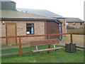
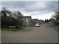
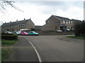
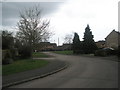
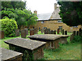
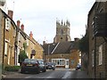
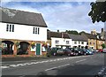
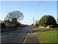
Photos of Deddington


Area Information
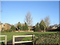
Deddington is a compact built-up area in England, spanning 60.6 hectares. Its population is characterised by a median age of 70, suggesting a community with a strong presence of older residents. The area’s small size and proximity to nearby towns like Banbury and Oxford make it a convenient base for those seeking a quieter lifestyle without sacrificing accessibility. Daily life here is shaped by a mix of local retail and rail connections, with Co-op stores and three railway stations within reach. The area’s broadband score of 100 ensures seamless online connectivity, while mobile coverage of 83 is reliable for most needs. Deddington’s appeal lies in its blend of practicality and tranquillity, offering a low-crime environment and a sense of stability. For those prioritising safety, convenience, and a well-connected location, it presents a compelling option.
- Area Type
- Built Up Area 250
- Area Size
- 60.6 hectares
- Population
- Not available
- Population Density
- Not available
Deddington’s lifestyle is shaped by its proximity to retail and transport hubs. The area has five retail venues, including three Co-op stores — Deddington, Bloxham, and Kings — offering everyday shopping convenience. These locations cater to local needs, from groceries to household essentials. Rail connectivity to Kings Sutton, Heyford, and Banbury ensures easy access to broader amenities, including dining, leisure, and cultural attractions in nearby towns. While the data does not specify parks or recreational facilities, the presence of multiple retail and transport options suggests a practical, community-focused environment.
Amenities
Schools
Deddington Church of England Primary School is the sole school listed near the area. It serves the local community with primary education, though no Ofsted rating is provided in the data. The presence of a single primary school suggests that families may need to look beyond the immediate vicinity for secondary education options. The school’s role as a central institution highlights the area’s focus on early education, but the lack of additional schools means parents should investigate nearby towns for broader schooling choices. The limited range of school types in the data does not allow for detailed analysis of educational diversity in the region.
| Rank | A + A* % | School | Type | Entry gender | Ages |
|---|---|---|---|---|---|
| 1 | N/A | Deddington Church of England Primary School | primary | N/A | N/A |
| 2 | N/A | Deddington Church of England Primary School | primary | N/A | N/A |
Explore more schools in this area
Go to Schools tabDemographics
Deddington’s population has a median age of 70, indicating a community skewed towards older adults. The most common age range is listed as “Total,” reflecting aggregated data rather than specific breakdowns. Home ownership is high, with 79% of residents owning their homes. This suggests a stable, long-term population with fewer transient renters. Accommodation types and household composition are not specified in the data, but the high home ownership rate implies a mix of family homes and single-occupancy properties. The area’s demographic profile is defined by its older demographic, which may influence local services and amenities. While no specific diversity metrics are provided, the absence of detailed data on ethnicity or religion means the community’s cultural composition remains unquantified.
Household Size
Accommodation Type
Tenure
Ethnic Group
Religion
Household Composition
Age
Household Deprivation
NS-SEC
Explore more demographic insights in this area
Go to Demographics tabPlanning
Planning Constraints
- Crime RiskLocked